Saturday, August 10, 2013

Some Nostalgia and a Little Bit of Crazy

TUESDAY, AUGUST 6 –
From the Woodchip Campground in Byron Center, MI last Sunday [4th], and by way of Rt. 131 N (through Grand Rapids) and I-96 W, I went back to the shoreline near Muskegon and turned southward once again on Rt. 31.

The highway eventually merged with I-94 W and I was passing signs for Detroit, Chicago, and South Bend – all familiar names and very much a part of my past.  We lived in South Bend from 1961-1968; I went to the Lutheran School for the Deaf in Detroit for one year in 1961; I went to a Yankees game in Chicago one day with Dad and [older brother] Welby, when I was maybe 12 or 13.  I also later saw signs for Indianapolis, and that’s where I spent five happy and productive years at the Indiana School for the Deaf.     

Spotting the telltale brown and white state park sign on the approach to Sawyer, MI, I was pleased to note that it was not yet noon.  At the entrance to the Warren Dunes State Park I was dumbfounded to see two long lines of about 50 cars.  This was totally unexpected!  Feeling uncertain and not wanting to get boxed in, I quickly turned around and kept driving on the Red Arrow Highway for about three miles.  STOP!  I told myself.  Stop and think about this.  Pulling into a gravel parking area in front of an antique store, I sat there for a few minutes.

Two points I considered:  Today is Sunday, a day when most people are not at work.  And those were all cars at the entrance; I did not see any RVs.  Isn’t it more than likely all those people are going to the beach and not to the campground itself?  Only one way to find out.  I turned back.

As it happened, there was a private RV Park across the road from the state park and I decided to stop there and inquire.  I first apologized to the owners for preferring the state park over their place, but they were A-OK about that and happy to confirm that those cars were indeed beach-bound.  The lady looked towards the entrance and with a flip of her hand said, “Oh, that’s not a long line at all!  Five minutes tops!”   

Now there were three lines and they did move quickly.  Those cars turned left to the beach and I turned right to the campground.  At the registration office I further discovered that there were plenty of spaces available.  I also learned that the campground is situated about a mile from the beach.  Not a problem.  I decided to pay for my site, grab a bite to eat, drive over to the beach for the afternoon, and then come back later and settle in for the night.

There was plenty of parking at the beach as well and that stretch of beach included a concession stand and a gift shop.  A high dune, dotted with people at the top, or working their way up or down, stood to one side and the beautiful blue Lake Michigan was on the other side.  The sun shone but it was also very breezy.  The red flags were on display, indicating hazardous swimming conditions.  There were people in the water regardless but I stayed on the beach with my book.   

Walking around later to take pictures and video, a series of flashing lights alerted me to the presence of several emergency vehicles nearby.  Unavoidably, I became a gawker and watched them rush to put two boats in the water.  Those boats ran, what I guess was a grid pattern, and then returned to the beach some 20 minutes later.  I don’t know what that was all about and didn’t linger any longer to find out.  It was 6:15 p.m. when I returned to the campground and this time there was a line of people waiting to go inside the registration office.  The first thing through my mind?  “Good thing you turned back when you did, MAP, ole girl!”


People on a high dune at the Warren Dunes State Park, Sawyer, MI


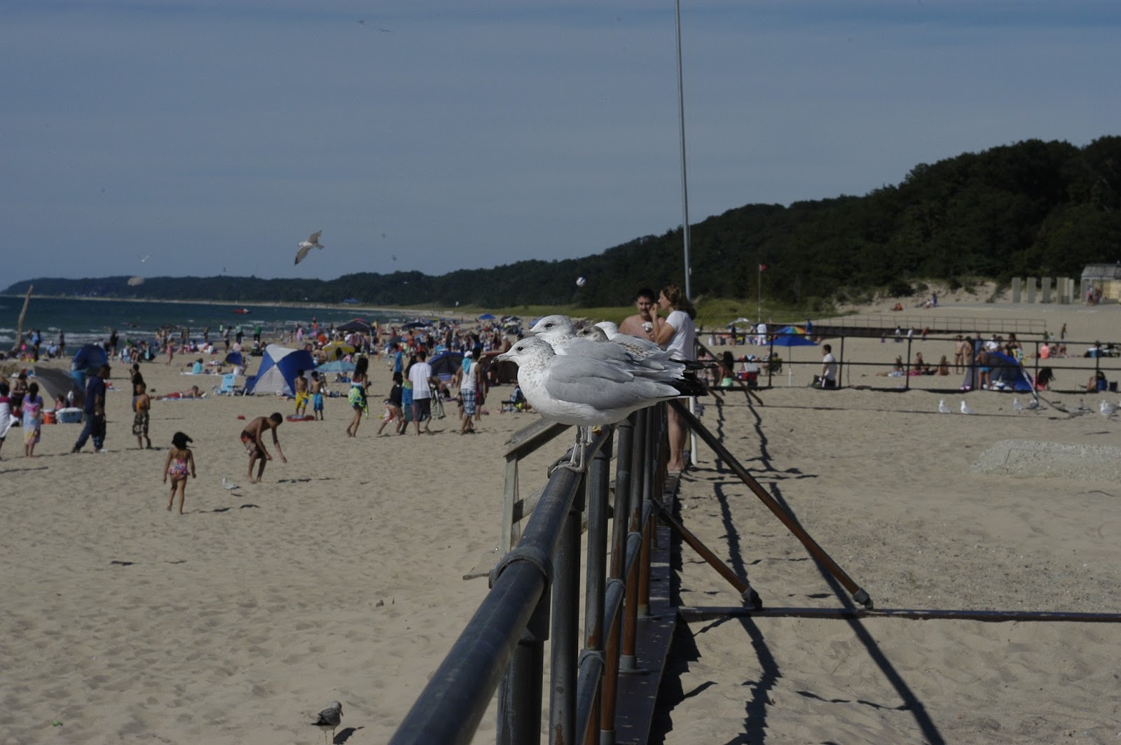
People on the beach, along with the ever present and food-seeking seagulls.


Just another view of Lake Michigan through my truck's window.

It turned out to be overcast, yet again, yesterday [Monday 5th] but I’m very happy that I had a great beach day on Sunday at Warren Dunes - my final Lake Michigan state park in Michigan’s Lower Peninsula.  I’m not finished with Michigan yet!  There’s the Upper Peninsula to visit later this month.

Getting back on the Red Arrow Highway, which soon became Rt. 12 S, I crossed into Indiana!  My first stop – the Indiana Dunes National Lakeshore Visitors Center.  They also have a WIFI hotspot so I lingered there for a while before heading out to the Dunewood Campground.  There are no hookups at this campground.  Reservations are not accepted.  It’s first come, first served.  You select your site and you self-register.  There were plenty of sites to choose from and, with my Access Pass, I got mine for $9.00.

The Indiana Dunes National Lakeshore, located between Michigan City (IN) and Gary (IN), is about 15 miles of beach, dunes, marshes, bogs, forest, and a wide variety of birds and wildlife make their home there.  There are eight access points to the beach and each has its own parking lot, the largest with 600 spaces and the smallest with 26.  The National Lakeshore also shares a section of beach and dunes with the Indiana Dunes State Park.  Unfortunately, there’s an eyesore right in the middle of this long stretch of shoreline.  Its name is “industry.”  There are two steel mills, a power plant, the Port of Indiana, and railroad tracks.  Thanks, however, to the diligence of long ago environmentalists and conservationists, and the wisdom of several state and federal legislators, much of this ancient and irreplaceable landscape was designated a national lakeshore before industry could do more damage.

Today, Tuesday 6th, I took a route diversion from Lake Michigan (via Rts. 20 E and 331 N) to get a site at the South Bend/Elkhart North KOA in Granger, IN.  Shortly after I arrived I started doing some laundry, checked emails, and watched some TV.  I’ve relatives to visit in South Bend tomorrow!

WEDNESDAY, AUGUST 7 –
Around mid-morning I got back on the highways that I had been on the previous day, reversed direction and drove towards South Bend – heading there to visit Uncle Bob (Mom’s brother) and Aunt Jan.  Since I was a bit early, I drove around and managed to find our house on Woodmont.  I traced the route I rode my bike on when I went to the drug store to buy Superman comic books or a chocolate soda.  Except for the Kroger, it’s all different now, what with all the chain stores and restaurants. 

I got to Bob and Jan’s by 1:00 p.m. and had a most enjoyable 90-minute visit with them.  They’ve lived in the same house for nearly 60 years - the same house where they raised all three of their children - and the familiarity of that cozy home was exceptionally comforting.  It was good to see them once again.


Uncle Bob and Aunt Jan, South Bend, IN.

Heading next for Chesterton, IN, I got there by way of Rt. 2/20 W and I-94 W.  The sky had been threatening rain all day and just as I got back on the road, it poured!  It was a torrential downpour my wipers were barely keeping up! 

Following the directions to the Sand Creek Campground I found a roadblock.  It was still raining and I was tired, mostly from the stress of driving in the rain and straining to read street and road signs.  My “grey matter” was all tuckered out and my sense of direction in this kind of weather usually goes kaput.  I looked around and decided I’d find help from somebody in the nearby Animal Hospital.  I found help alright and with new directions in hand, arrived at the campground in no time.  I was told to pick any spot on the big grassy field and just as I set up the camper and sat down at the dinette table, the sun came out.  It was late afternoon and the sun’s rays were angled just right it made the raindrops on the bright green grass and leaves glisten.  It was so pretty.  It was also short-lived.  There was a boom, I jumped, and it poured again. 

THURSDAY, AUGUST 8 –
This morning I decided I had better go to a RV service facility and get the camper’s rear lights checked out and fixed.  I found out last week that not only was the right-side brake light still malfunctioning, the back-up light on the left side wasn’t working either.  The fella assisting me discovered that the plug for the back-up light had disconnected and the prongs on the plug for the brake light were dirty.  He cleaned both, we tested both, and they checked out OK.  No charge, he said.

Back on I-94 W, heading for Chicago, it wasn’t long before I was surrounded by trucks – more trucks than cars, it looked like!  Since I don’t have GPS, and I had a stop to make in Chicago, I accessed Mapquest online a few days ago and copied directions for the journey through this metropolis.  It was quite a sight, the Chicago skyline to my left and Lake Michigan on my right.  It was beautiful to see and I was so glad it was a beautiful day as well.  Not a drop of rain on this day! 

I was doing really well with my directions…until I missed a merge onto Lake Shore Drive, which follows the shoreline of Lake Michigan.  Now I was in downtown Chicago, me and my hulk of a truck camper among this tight horde of swarming cars and people!  Relax, Hon-Bun.  Just stay north and turn east towards the water.  Lake Shore Drive will materialize somewhere.

Back on track I soon reached Greenview Avenue, parked nearby (now that was a lucky find on this narrow one-way street!), rang the doorbell, and received a warm hello from Jakob, the Archivist at the Leather Archives and Museum.  He was expecting me, based on earlier email correspondence, either today or tomorrow. 

Traveling with me, from the very moment I left home on June 2nd, and securely tucked away inside my truck, were items I was now getting ready to pass on to LA&M.  There were materials my friend Philip wanted to donate and, knowing that I would be driving through Chicago on this camper trip, he asked if I would drop them off for him.  Additionally, since I was the recipient of leather and denim vests that had belonged to my deceased friends, Ernie, Bill, and Justin, I agreed with Philip’s suggestion that I donate these vests to LA&M as well.  I had had these pin-studded (and quite heavy!) vests since 2004 and parting with them today was quite emotional.  But they are now in good hands and in a good place! 

Jakob said I was welcome to see the exhibits in the museum – no charge!  So I walked around (and learned a thing or two, too!) and Jakob even showed me the [Staff Only] Archival area, including a room full of donated leather vests.  In response to my question about the pins on the vests, he said everything will be left intact, including the name tags.  Nothing will be altered, removed, or sold.  What a wonderful place and a fascinating visit this was!  Thank you, Philip, for the suggestion! 

On my way once again, and looking for Sheridan Road, road construction screwed me up and I was making a series of wrong turns here and there.  I also had a hairy moment when I approached an overpass that measured at 12’6” – the height of my truck camper comes to just under 12 feet!  On Sheridan, finally, it was a most lovely drive – long and winding through Chicago’s northern suburbs.  I couldn’t see Lake Michigan but it didn’t matter because I was treated to miles of big, beautiful homes along both sides of that road.  They looked like mansions really!

I soon reached Zion, IL and got a site at the Illinois Beach State Park.  I’m now on Lake Michigan’s western shoreline where, instead of the sun setting below the water, the sun rises above the water.  To see that, I will have to get up early.  I’m not too sure that’s gonna happen for this non-morning person!

FRIDAY, AUGUST 9 –
Aw, I missed the sunrise…by about an hour, give or take.  It was about 7:30 a.m. and at the beach there was me, some folks walking their dogs, and several small groups of teenage runners and joggers.  There was also a man close by who might have been their coach.  A summer camp group?  High School track hopefuls?  I don’t know but I enjoyed watching them sprint on the sand.  

Lake Michigan's shoreline on the Illinois side; Illinois Beach State Park, Zion, IL.


Early morning sprinters, graced by the morning calm of Lake Michigan.

I learned something yesterday.  When I registered for my site at the state park I asked the lady in the office if she knew whereabouts in the area I’d find a WIFI hotspot.  She said McDonald’s.  Dang!  All this time I’ve been traveling and McDonald’s is everywhere!  I had no idea!  Yesterday I had a Chocolate Chip Frappe while checking my emails.  It was pretty good.  This morning I had a mocha coffee.  I really should avoid the stuff at fast food places so maybe Diet Coke should be my beverage of choice in the future. 

I got the truck fueled up and then about 10 minutes later, on Rt. 32 N, I crossed into Wisconsin and headed towards Milwaukee.  Route 32 cuts right through Milwaukee’s downtown and northern suburbs and this turned out to be one wild drive.  The streets in Milwaukee are in terrible shape and my zigzag of a route took me through an assortment of potholes – some patched and some not - road detours, road work areas, bumps and more bumps, parked cars and bicyclists on MY lane, a raised drawbridge, and one overpass that measured 12 feet plus some.  YIKES, but I made it under and through that one and, once my heart steadied, yelled at myself “Don’t do that again!”  I drove as slowly as I could and hit the brakes many times, but every friggin’ bounce made me cringe.  I was muttering under my breath – “I’m sorry, Truckie.  I’m sorry, Lancie.  You’re crazy, Mappie!”  On the plus side, I got to see downtown Milwaukee and many more big beautiful homes north of the city…and the occasional glimpse of Lake Michigan off to the right.

Eventually, I got on I-43 N and then Rt. 33 W, heading for West Bend, WI.  As I had done on so many weekends in Michigan, I decided to do the same this weekend - leave the shoreline and stay somewhere inland.  I have a site for tonight and tomorrow at the Lake Lenwood Beach and Campground, in West Bend.  Their lake looks like a pond to me, but they have a beach!

Saturday, August 3, 2013

More Than One Way to Get Wet!

SUNDAY, JULY 28 –
The weather yesterday [Saturday], when I woke up and looked out the window, was rainy.  Aw, this RV Park (the Silver Creek Luxury RV Resort & Campground in Silver Lake, MI) is expensive, but, I’ve got the cable TV and the WIFI, so why don’t I just stay here another night, I argued with myself.  The lady yesterday said they might be full today, remember?  Yeah, but she also said to check with them at 10:00 in the morning, remember?  So, I walked over to the office and asked.  No, they are filled up.

I left around 11:30 a.m. and, taking a road (B-15) through the vicinity, I noted not only the horde of people, on foot and on bikes, but the stores and restaurants and the many signs for “Dune Buggy Rides” and buggy, jeep, boat, and Jet Ski rentals.  I haven’t seen these particular dunes yet and when I happened to pass by the Silver Lake State Park and saw the “Sorry, Full” sign, it was obvious that this is a very popular recreation area.  I’ve got to check out this place!

The best thing to do, I decided, was to go from the water to the woods to wait out the weekend…and the wet weather.  Go east, girl!  And that I did, getting back on Rt. 31 S for about five miles and then connecting to Rt. 20 E towards the White Cloud/Newaygo area.  It rained off and on but it was a nice enough drive through farms, orchards, and woods.

Initially planning to go to a state park, I noticed signs for the Sandy Beach County Park and decided to try a county park this time.  The lady in the office assigned me site #63 and when she pointed it out to me through the window she said, “Oh, there’s a car that’s not supposed to be there.”  She suggested she ride with me to the site and she’ll ask the owner of that car to move it.

To set the scene:  Sites are marked on numbered posts.  The park pass on that car’s mirror said #64.  It was, however, parked on #63, my space.  There was a second car on #64.  There were two tents on that site.  The owners of both cars were not there.  Nobody knew where they were, including this fellow who walked over from his site.  The space between that car, at the left, and a post, at the right, was barely wide enough for me to squeeze through, but, and with guidance from the lady from the office and the fella who walked over, I was able to pull through and get situated where I needed to be.

After taking a walk around the park, and checking out Hardy Pond and the nearby dam, I returned to my camper in time to catch one of the park employees swinging by.  He said he had been going around looking for the folks on #64.  He finally left a note on the intruder car’s windshield which basically said to “move it.”  

It turned out the folks on #64 had three cars.  Interestingly enough - for me anyway, me and my sometimes outlandish imagination - there were just four people, two men and two women.  When I saw that third car pull in, I went to my door and stood there looking out through the screen.  The owner of the interloper car, a woman, saw me and immediately got in her car and moved it.  She didn’t even read the note!  She didn’t offer a gesture or a word of apology!  The nerve!

At this point in time, it’s been 8 weeks since I left home and 7 weeks since I’ve officially been traveling in my camper.  Considering all the earlier hiccups with the camper and camera, I think I’m now on good terms with them both!  The truck has been great, too!

It was still wet and gray and a bit cold on this Sunday morning.  I decided last night that I would relocate to a nearby private RV Park which has WIFI and other amenities.  In no hurry to leave, I sat at the dinette table and watched a family across the way dismantle and load up their cars with camping stuff, bags of trash, and kids.  The #64 folks had already left earlier.  I got going myself at around 11:30 a.m.

By noon I had comfortably relocated to the Woods and Water RV Park, which is located between White Cloud and Newaygo.  Being that there’s a small lake here, the owners picked a great name for this RV Park.   

MONDAY, JULY 29 –
Like night and day!  What a huge difference today is from last Saturday morning.  Going to Michigan’s forest for the weekend was a smart strategic decision.  I won’t claim all the credit though.  The relentlessly cool and rainy weather may have been a factor as well.

It was 10:30 this morning when I steered my truck back to the Silver Lake area, arriving there before noon.  Driving slowly on that same B-15 road, it was a good sign when I noted how light the auto and foot traffic was…compared to last Saturday.  A more hopeful sign was the missing “Sorry, Full” proclamation at the entrance to the Silver Lake State Park.  The young lady in the office said I had a choice of available sites and I picked one with an excellent view of Silver Lake and the sand dunes.  Beyond those dunes, and out of sight, is Lake Michigan.

Before setting up the camper, I drove to the nearby town of Mears, looking for the Post Office.  I found that and then, spotting a coffee shop across the street, went there to see if they had a WIFI hotspot.  They didn’t, BUT they did have French Vanilla!  The only time I will drink black coffee is if French Vanilla is available.  Cream (or milk) and sugar doesn’t do it for me.  So, I bought a cup and it sure was good on this cool day!  I followed that with some lunch back in Silver Lake and then settled down at my campsite.  By late afternoon the sun peeked through the clouds.  Another good sign!
 

The sand dunes of Silver Lake, complemented by a sailboat. 
Silver Lake State Park, MI.

My chair, my book, my cocktail, and my view of Silver Lake.
 
A family wading to their boat for a sunset sail on Silver Lake.

O'er the dunes, against the backdrop of a rain-cleared blue sky, the sun set.

TUESDAY, JULY 30 –
It was a beautiful sunny morning and I walked over to admire the morning’s light on Silver Lake.  People were up and about and so were the birds and some ducks in the water.  I took some pictures –


Silver Lake on a sunny morning - as enjoyed by some ducks...
 
...and boaters, too!


Curious about where the dune access was for the ORVs (off-road vehicles) I headed for that area.  The parking lot wasn’t full but as I turned around to leave I noted the arrival of a caravan of ORVs, equipped with orange flags atop long poles.  Sure looks like a fun thing to do!

Still up for a bit more sightseeing I took a narrow winding road to the Little Sable Point Lighthouse.  The Lighthouse Keeper’s residence is gone but the lighthouse, built in 1874, has been restored and, for a $3.00 donation, you can climb the 130 spiral steps of the 108 ft.-high red brick lighthouse.  I had a quick flashback, remembering two lighthouses that I climbed some years ago – the [144 ft.-high] Tybee Island Lighthouse, near Dad’s place on Tybee Island (just east of Savannah, Georgia), and the [187 ft.-high] Cape Hatteras Lighthouse, on North Carolina’s Outer Banks.  Deciding that my lighthouse climbing days were pretty much over, I went down to the sandy white beach instead.   


Little Sable Point Lighthouse, on Lake Michigan, Silver Lake Sand Dunes Area.
 
Dune grass.

Next stop, the Muskegon State Park (via Rt. 31 S and 120 W) in North Muskegon.  A very woodsy state park, this one, with lots of trees around all the sites.  Steps led down to the beach and that’s where I went, to enjoy the sunshine and to read a bit.  The water was cold and it took a lot of self-prodding to suck it up and submerge myself!

WEDNESDAY, JULY 31 –
I think it’s a fair observation to note that, in addition to eating, drinking, sleeping, and crapping, looking skyward is something all humans do, the world over, every day.

It’s raining again this morning!  Oh, Michigan, how fickle thou art!  But…rain sustains life and it certainly has been good for the fruit orchards around here! 

Okay, Mappie!  You know what?  The truck needs an oil change so let’s go inland and make that happen.  Back on my well-travelled Rt. 31 I then turned east on Rt. 46, towards Cedar Springs, and got a site at the Lakeside Camp Park.  Before setting up the camper, I went to the local Ford dealership and asked about an oil change service for the truck.  The fella there, Mike was his name, said that because of the camper on the truck, they will have to do the work outside.  But not when it’s raining.  I gave him a little bit of my distressed oh-oh-oh look, then asked him what the weather forecast was for tomorrow.  He whipped out his mobile and we both learned that it’s gonna be partly sunny.  “See ya tomorrow!” I said.

Additionally, it’s the end of the month and this unplanned excursion inland to this RV Park, which has excellent WIFI connection, has prompted me to take care of my August bills ahead of time.  While doing that this afternoon, I looked up often from my laptop to admire the view from my site.  It’s an old barn, just a few yards away, partly covered by ivy and surrounded by high grass.  I like old barns.  I think debilitated old barns have a lot of character.  Just think of the stories they could tell.

Even in inclement weather, I find things of interest...like this old barn. 
Cedar Springs, MI.


THURSDAY, AUGUST 1 –
“Happy Birthday, Dad!”  Had he lived, Dad would have turned 96 today.  He was a swell guy and quite a character! 

The sun was out this morning so I got ready to take the truck back to Ford.  Having already decided to stay here another night, I first stopped at the office to pay for my site – the one with the view of the charming old barn!  There’s a small fish-stocked pond behind my site, but the barn is lively, with birds flitting around and the overgrowth swaying in the breeze. 

The oil change and general all-around check of the truck was finished in about an hour's time.  All's good, Mike said.  I was back at my site just before noon.


Getting the truck serviced at the Cedar Springs Ford.
 

The old barn, at dusk.
 
SATURDAY, AUGUST 3 -
Before leaving Cedar Springs yesterday [Friday 2nd] I got some breakfast at a family restaurant.  It got cloudy again but I didn’t particular mind because Thursday was perfect for the We-have-to-do-it-outside-oil-change and I’m not heading back to the shoreline until Sunday.
 
Michigan’s countryside is beautiful and I enjoyed my drive along Routes 131 S, 57 E, and 66 S to the Ionia State Recreation Area, near Ionia.  I arrived around 1:45 p.m. only to find out that all the sites at the “modern” campground (translation: with electricity) were full.  The lady in the office said there’s plenty of spaces at the rustic campground and I told her I was OK with that.  My only request was for something level and her response was, no worries, the spaces are big and grassy.  When she showed me my site on the map, I said, “Horses!”  She was giving me a site at the Equestrian Campground!
 
Lordy, my site is huge!  You could fit three truck campers there!  Of course!  They are spacious in order to accommodate horse trailers as well as RVs and trucks.  At the rear of my site were three hitch posts and each one had a thick eye screw near the top – to run the rope through, I figured.  I took a close look around and found strands of horse hair on one of the posts, a couple of hoof prints, and manure and hay that had been tossed into the woods.  I had no neighbors within my immediate vicinity but, just wait and watch, and sure enough, two teen girls came trotting by on their horses.  Pretty girls I thought, but the horses were gorgeous!  This is the second time I’ve ever camped in an area for horses.  I should do this more often!
 
I took a walk around the campground before it got too dark and marveled at how large the spaces were.  There are horse trails at this SRA and manure depository sites, complete with pitchforks, shovels, and wheelbarrows.  I came upon those girls’ site and saw that they had five horses and two horse trailers.  Now I could see the rope through those screws.  The horses and their feed bags were tied to that rope.  Although there were two other RVs at the campground, this group was the only one with horses.  This morning, Saturday 3rd, I counted four groups, including a family with young children.  Lucky kids!
 
Manure depository at the Equestrian Campground, Ionia State Recreation Area.
 
Horses tethered at their spacious campsite.
 
Morning feeding.
 
Shortly before noon today I arrived at the Woodchip Campground in Byron Center, MI, just south of Grand Rapids.  Tomorrow I will return to the Muskegon area, pick up where I left off, and continue my shoreline drive south.  Soon I will arrive at the southernmost arc of Lake Michigan…

Friday, July 26, 2013

Cool Blues, Dunes, and Wildlife

WEDNESDAY, JULY 24 –
As I write this I’m at the Orchard Beach State Park in Manistee, Michigan.  The heat wave and humidity that had blanketed this region last week is now a distant memory.  When I left the RV Park in Traverse City last Sunday [21st] it had become much cooler and drier.  Ready to move on that morning, I got back on Rt. 31 S for just a few miles before I turned north on Rt. 37 to head up the Old Mission Peninsula.  The peninsula, which juts up the Grand Traverse Bay, is about 20 miles long and three miles wide at its widest.  The bay on the east side is called the East Grand Traverse Bay, which means, obviously, that the bay on the west side is called the West Grand Traverse Bay.  Rt. 37 is the only major highway that traverses the north/south route of the peninsula.  As I drove up to the tip I noticed a lot of orchards and vineyards along the way. 

The restored Mission Point Lighthouse, built in 1870, is located at the “Dead End” of Rt. 37 and since I had to turn around right there I decided I might as well stop and walk around for a while.  The gift shop had a free local map and when I noted all the side roads I knew immediately I was not going back south on Rt. 37.  Kinda hard to get lost on this little sliver of land, I figured.

I turned left here.  I turned right there.  Goodness, there’s the historic Old Mission Inn, built in 1869.  The chairs on the big porch provide a wonderful view of the East Grand Traverse Bay.  There’s the Haserot Beach and the Old Mission General Store, the original store and trading post since 1839. 

Orchards.  I wanted to see orchards.  So I turned west, crossing Rt. 37 over to the West Grand Traverse Bay.  Referring to the local map, I got on a couple of narrow farm roads and was soon in the middle of groves of cherry and other fruit trees.  I found a place to pull over for a close look at the bright red cherries and to take pictures.  I picked one up from the ground, just to feel the texture.  I did not pick a cherry from a tree.  Mama taught me well!

With the bay on my right, serving as my guide, I headed southward to return to Rt. 31.  People live on this peninsula and there were many lovely homes along this drive. 
 
 
The rocky shoreline of East Grand Traverse Bay, as seen from the site of the Mission Point Lighthouse, Old Mission Peninsula, Michigan.
 
 
A grove of cherry trees on Old Mission Peninsula.


Cherries!
Back on Rt. 31, again for just a few miles, I then turned onto Rt. 22 N to visit the Leelanau Peninsula.  First the “thumb,” then the “tip of the mitt,” and now I’m on the “little finger” of Lower Michigan! 

Route 22 traverses along both the eastern and western sides of the peninsula.  It splits at Northport, but, by way of a couple of county roads, I drove all the way up to the peninsula’s tip and got a site at the Leelanau State Park.  After a short walk on a path to check out the water I then walked over to the Grand Traverse Lighthouse, which is situated right here within the state park.  Since all the sites here are rustic (no hookups), I opened the propane tanks for the fridge.  Still wary about my camper’s batteries, I kept the dinette slide-out closed.  But I did heat up some soup on the propane-fueled stove!  Since I have a propensity for screwing up anything I try to cook – and probably have the cleanest stove and oven in camperdom - my success with the soup is to be celebrated!

Monday morning [22nd], and on the western side of Rt. 22, I drove south though a lovely landscape of orchards, vineyards, wineries, woods, and lakes to the Village of Empire and stopped at the Sleeping Bear Dunes National Lakeshore Visitors Center to get campground and other information.  From there I took Rt. 109 towards the Glen Arbor Village and turned into the D. H. Day Campground.  It was about noon and there were three parties ahead of me.  I looked at their vehicles and they appeared to be tent campers.  Holding my breath and keeping my fingers crossed, I soon found out they had just a few spaces left!  Named last year the “Most Beautiful Place in America” by ABC’s “Good Morning America,” the Sleeping Bear Dunes is a popular national lakeshore and the limited number of unreserved spaces are quickly snatched up.  Feeling extremely lucky, I got a site for tonight and tomorrow.      

Before setting up at my [rustic] site I went to the Glen Arbor Village to look for a WIFI hotspot.  I found it in a coffee shop and hung out there, with a Frappuccino, for about an hour.  Again I opened the propane tanks but not the slide-out.  With hours of daylight left, on this sunny and warm day, I went to the beach with my 3rd book of the trip.  The various hues of blue on Lake Michigan, indicating water depth, are most evident on a sunny day.  From where I sat, aqua was the color of the water closest to the shore and dark blue beyond.  Nearby are the North Manitou and the South Manitou Islands, accessible only by ferry.  I went in the refreshingly cool water twice.      

It turned out to be cloudy, breezy, and very cool on Tuesday [23rd].  While I will always prefer my travel days to be sunny and warm – for beach and photography reasons – I was grateful that today at least was not humid and it did not rain.  I set out at 9:30 a.m. stopping first at the nearby historic Glen Haven Village.  This used to be a bustling lakeshore village, populated by lumbermen, fishermen, and visitors.  Extending yards out in the water was a long dock where ships would anchor to drop off and pick up cargo and passengers.  Wood pilings of that dock can still be seen in the water and some buildings, including an inn, still stand.  They’ve been restored/renovated but at the time of my visit they weren’t open.

The beach at the Glen Haven Village, with South Manitou Island in the background.  Sleeping Bear Dunes National Lakeshore.

I then went to the Dune Climb and climbed the 110-foot high sand dune.  It was tough going and I had to stop about 10 times to catch my breath.  I tried to nonchalantly make it appear I stopped to look around (heh, heh) and it was quite satisfying to see other people stopping for a moment, too!

Getting up that dune, I saw that the sand leveled out for some yards and then there was another dune, but not quite as high.  I made it up that one and saw still another dune!  By that time, the clouds had gotten darker, the wind had picked up, and it had become a lot cooler.  I was in t-shirts and shorts and wearing my sneakers.  Off to my right was a dune that had patches of dune grass and other vegetation on it.  A narrow sandy path led up to several elevated ridges and, since it looked like an easier climb, I went that way up to the highest ridge.  From there I could see Lake Michigan.  I think the people that crossed that third dune reached the shore itself.  Feeling pretty good about my considerable efforts, I headed back down to the parking lot.  The return was a whole lot easier and it was fun watching kids of all ages and nationalities having a great time.  It is universal, this joy that kids exhibit with wild abandon.  We adults could learn from them!    


The "Dune Climb," Sleeping Bear Dunes National Lakeshore.
 
 
Looking back the way I came.  Glen Lake in the background.
 
 
Looking up and over a ridge to Lake Michigan and the South Manitou Island.
 
My next adventure was an auto tour on the scenic 7.4-mile Pierce Stocking Drive.  There were 12 points of interest and I stopped at most of them to look around and to read the descriptive guide I had purchased.  Needless to say, the most popular stop, and the one with the packed parking lot, is the Lake Michigan Overlook.  Here, at the top of a high ancient glacial bluff, a mixture of sand and stones, was an impressive view of Lake Michigan and the two Manitou Islands.  The way down the bluff to the rocky shore is extremely steep.  A lot of hardy souls went down easily enough.  There was only one way back - up that same steep bluff!  Many people resorted to getting down on their hands and knees and crawl back up!

The Pierce Stocking Drive, Sleeping Bear Dunes National Lakeshore.
 
 
A very steep bluff down to Lake Michigan, from the Lake Michigan Overlook, along the Pierce Stocking Drive.  
 
To wrap up this fantastic day, I went to Glen Arbor for a late lunch.  I haven’t been eating out much so this was a rare treat for myself.  Being that it was too cold for the beach, there were lots of cars and people in the village.  The coffee shop was my last stop before I returned to my camp site for the night.  As I backed in I thought, “Aw, MAP, open the dang slide-out.”  So I did.

This morning (Wednesday 24th), the first thing I did was close the slide-out.  No problems at all!  I had decided last night that if it wouldn’t close due to insufficient battery power, I would just start the truck and let it charge up the camper’s batteries while I got ready to leave.  It sure was a relief to discover I didn’t have to do that.

As I approached the exit of this wonderful Sleeping Bear Dunes campground, I was very surprised to see this long queue of cars – maybe 12 total – outside the registration office.  People were standing around outside, waiting their turn to go in the office.  It was only 8:30 a.m.!  Maybe they had reservations but I am glad this is not what I experienced when I arrived last Monday!

Look for it, girl.  If you look for it, you’ll find it.  Just as I drove through Empire, back on Rt. 22 S, I saw it!  Making my entrance, there were four gentlemen ahead of me.  They all had white hair, or grey hair, and various degrees of baldness.  One fellow had a comb-over.  I figured on one hour so I sat down and read a People magazine.  When it was my turn, I told the barber – “Clipper #2, all over!”  Ten minutes and $7.50 plus tip later, I was on my way with my newly shorn head!

Although the Leelanau Peninsula pretty much ended just south of Empire, I was still hugging the Lake Michigan shoreline and decided to pull into the first scenic turnout I saw.  Unlike yesterday, the weather is clear today and the sky is blue, and I wanted to see those blue hues of Lake Michigan.  Climbing up a lookout platform, I wasn’t disappointed.  As there was no wind either, the water was calm…almost like glass.  Seagulls were gliding above the water, some plucked something from the water, a few floated on the water.  Nothing really unusual about all this, except that this time instead of looking up at them, I was looking down.

Lake Michigan, seen from an overlook platform, somewhere along Rt. 22. 
 
For tonight I got a site at the Orchard Beach State Park in Manistee.  The state park is also on top of a bluff and there are steps leading down to the beach.  I didn’t go to the beach today but did admire the view and the sunset from the top of the bluff.  Earlier, as I was driving through the state park to pick my site, this fellow got my attention and informed me that the brake light on my camper’s right side wasn’t working.  Nor was the turn signal.  How long it’s been out like this, I do not know. 
 
 
Lake Michigan, as seen through my kitchen window, Orchard Beach State Park.
 
 
The colors of a setting sun on the sand and trees, Orchard Beach State Park.
 
THURSDAY, JULY 25 –
Route 22 ended at Manistee and I continued south on Rt. 31.  Heeding the advice I got from someone yesterday, I stopped first at the local Chevrolet dealership to ask if they could look at the camper’s brake light.  It wasn’t broken.  Just a loose connection, apparently caused by all the jostling and bouncing around that happens when I travel around in the camper.  They tweaked and tapped the little round red thingie, but this is on my list for David, my Galaxy Campers guy, to look at when I get back home.

It’s a good thing I ignored my initial thinking that maybe I’d skip the Ludington State Park [in Ludington, MI] today and go somewhere else.  Once I passed through the town and saw all the sand dunes around Lake Michigan, I perked up.  Further, it’s a good thing I ignored – completely ignored - the “No Vacancy” sign at the park’s registration office.  It was 11:00 a.m. and the woman in there was all smiles when I walked in.  I said “Hi, I see your sign but I thought I’d ask if maybe somebody has left and there’s now a vacancy?”  She checked her computer and, yes, there’s three at the Pines Campground!  I picked #42. 

Dubbed the “queen of Michigan State Parks,” Ludington State Park is located on the shore of Lake Michigan and “…is comprised of nearly 5,300 acres of scenic sand dunes, over five miles of Lake Michigan shoreline vistas, ponds, forest and Hamlin Lake.”  It is also home to the restored Big Sable Point Lighthouse, one of the oldest lighthouses on Lake Michigan.  A posted notice at the office advised that fawns were born in May and June and to please leave them alone because, even though their mothers will walk away when they see people, they have not been abandoned.  Another notice advised that the raccoons are cunning and fearless and campers, especially tent campers, should leave their food and trash inside their vehicles.

A bite of lunch first, followed by about an hour of writing.  At 2:00 p.m. I set off for a walk.  First stop (but, of course!) the beach and the restored Beach House, constructed by the Civilian Conservation Corps in the late 1930s.  The sandy beach and water looked so enticing but I decided it was a perfect day – sunny and in the mid-70s – to walk on the bike paths and other trails and see things other than Lake Michigan.

The first bike path I got on followed the shore of the Big Sable River where people were lazily floating by on inflated tubes.  I had my binoculars with me and used it every time I detected movement.  As I began my walk through the forest section, I spotted a deer. She saw me too but wasn’t spooked at all.  I saw birds, two that I recognized as a robin and a woodpecker, and a yellow and a blue bird that I couldn’t identify.  On the way back to my campground, I saw another deer and her fawn.  The fawn walked around, nibbled at the ground, and then laid down among the leaves.  I lost it and then found it.  It certainly is amazing how a fawn's light brown color and white spots camouflage it so well.

It was 6:00 p.m. by the time I returned to my camper.  It was a very satisfying and pleasant four-hour walk and I was glad I took this time to see the geological diversity of the area…and some of the wildlife!
 
 
The beach at the Ludington State Park, Ludington, MI.
 
 
Listen up, people!

 
Sand dunes, trees, Lake Michigan, Ludington State Park.
 
 
A fawn in the woods, Ludington State Park.
 
 
One of many ways down to the beach! 
 
FRIDAY, JULY 26 –
I had learned yesterday that inclement weather was in the forecast for today.  The morning started off nice enough and after getting some groceries I got back on Rt. 31 S and, less than an hour later, arrived at the Silver Creek Luxury RV Resort & Campground in Silver Lake, MI.  The resort has WIFI, which I need so I can post my blog, and cable as well for the TV.  The lady in the office said they were full, but then she said, wait a moment…somebody is supposed to check out and they haven’t yet.  Eventually those folks left and I got that site for tonight.  About 30 minutes after I got settled in the camper, it rained.

I think I’m going to make a “weekend route diversion” away from the shoreline tomorrow.  Maybe I’ll head for the woods…