Saturday, September 24, 2022

“My Faves: Lakes, Dogs, and a Cat”

Sunday, September 18, 2022 I posted Blog #5 around 12:00 noon today. Folks who had arrived, one after the other, yesterday all left this morning.

There’s a tree about a foot or so from my slideout and, every now and then, I’d be entertained by squirrels scampering up and down the tree. As I write this, it’s quite hot here and the pool [here at the North Little Rock KOA] is both empty and inviting. Gonna take a break now, take a dip, and rest.

Monday, September 19, 2022 Soon as I woke up, while the rising sun was still low in the sky, I got out of bed and got going on my chores for today.

First, since I’m still getting a sulfur odor from the water coming out of the faucets [from the fresh water tank], I drained that water down into the grey water tank. I then filled up the fresh water tank with the water from this KOA. If the sulfur odor still persists, I’ll address it later with David, my camper guy, when I get back home.

Dumping the black and grey water tanks was next. As happened once before on this trip, my sewer hose wasn’t long enough to reach the sewage. A longer hose would definitely be better, but then, it may be too long to fit in the compartment where the hose is stowed. So, my resolution for this scenario was to retract the slideout, unplug the shore power (switching fridge to battery power), and move the truck forward to bring the hose closer to the sewage. Why didn’t I park this way when I arrived last Saturday? Because (a) my truck’s front end would then be way too close to the road that RVers use to exit the campground, and (b) because of the slideout, it was better to set up the camper a bit further away from the tree on my site.

The dumping done, I then did some interior cleaning, took a shower, and did my laundry. Around 1:30 p.m., I turned my attention to my travel materials, formulated a plan for the remainder of this week, and made campsite reservations. Online booking reservations were immediately confirmed for tomorrow (one night) and Wednesday (one night). Feeling like I was on a roll, I moved on to securing a two-night Thursday/Friday reservation at the Hot Springs National Park (via www.recreation.gov). Nothing was available at this national park for my specific RV criteria on those dates, so I tried a state park, and then another, and then another. Nothing was available at those parks either – on those dates!

“Those dates.” Ahhh, it soon occurred to me – I bet the culprit is Friday, the beginning of the weekend. I went back to one of the state parks that interested me, keyed in just one night – Thursday – and quickly got a site. As per my routine, since I’ll want to post Blog #6 (this one) over the weekend, I booked reservations at another KOA for Friday and Saturday. That done, I went to bed.

Tuesday, September 20, 2022 Leaving the KOA at around 9:45 a.m., I took I-40E back towards downtown North Little Rock and then took the exit for I-30W. “Dang this road construction that’s going on,” I grumbled to myself as I drove on rough pavement. A few minutes later I broke into a smile because, noting that the skyline somehow looked familiar, I looked to my left and there they were -- the pedestrian bridge and the Clinton Presidential Library! I was now crossing the Arkansas River on the same vehicular bridge that I could see from my site at the Downtown Riverside RV Park.

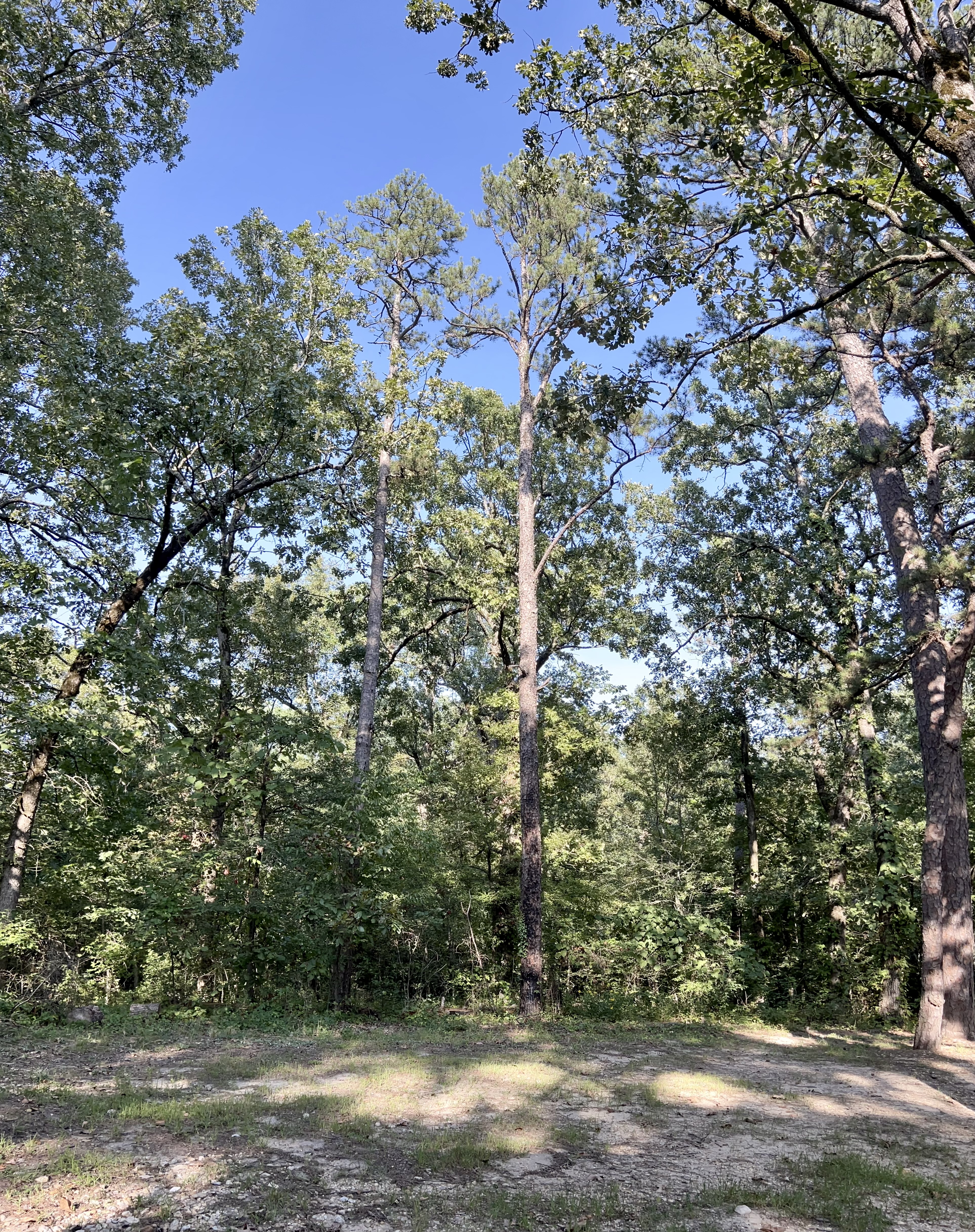
My destination today, a 2½ drive, is the White Oak Lake State Park, near Bluff City. To get there, once past North Little Rock, I took a series of highways -- I-530S–Routes 167S–79S–278W–24W–76–387. Oh yeah, sure, there’s quicker and more direct routes to get to the state park, but where’s the fun in that?

My drive – and today was another beautiful blue-sky day – enabled me to see more of this southwest Arkansas countryside. My 4-lane route soon became a winding 2-lane through the Poison Springs State Forest, so named “… from a nearby spring of the same name and is the site of a significant Civil War battle. The Battle of Poison Springs on April 19, 1864, was a convincing victory for the Confederates, forcing the retreat of Union forces north. The forest proved to be an asset to the Confederates and trouble for the Union soldiers who had difficulty maneuvering through the thick pine stands.”

After registering at the Visitor’s Center, I looked around their exhibition area…and met Bruiser! The sign next to his tank read – “Bruiser is our newest resident at White Oak Lake State Park. He was confiscated by AGFC in Caddo Valley as an illegal possession. We believe that Bruiser was born in the spring of 2022. Bruiser will live at White Oak Lake State Park for 1 year or until he grows too big for his home here and then he will go to the Hot Springs Alligator Farm.” I told the lady there that I just recently found out that there are alligators in Arkansas. She said, yeah, even here at the state park.


As mentioned above about Poison Springs, Civil War battles took place in this general region and the exhibit featured recovered items from that era. The display included bullets (some fired and some dropped in the field), cannon projectiles, a belt buckle, a part of a harmonica, and a nipple wrench (musket tool). I’m not a Civil War buff but I’m standing where it happened.

I have a nice site, with trees all around, and overlooking the Lower Portion of White Oak Lake. Seeing a small deck on the water between my site and the one next to me, I walked over there and was AGAIN -- for like the fourth time on this trip – startled by a medium-sized dog that I didn’t see until it was RIGHT THERE at my side. The dog sniffed me, looked at me, and then started yapping at me. I just stood there, speaking softly “Hey, it’s alright…” until his owner came by, all apologetic and saying his leash broke. Alright, all’s good.

Continuing my walk, I checked out the marina, the fishing dock, and two peninsula-like strips of land jutting out from the shoreline. I don’t know what they call that land mass here (I think it’s “spit” elsewhere) but they’re both narrow, grassy and easy to walk on. It was a nice mid-afternoon stroll and, come evening, I stepped out again to take sunset pictures. When it got dark, I decided to go back outside and take pictures of my camper with all its exterior lights on. Those came out blurry -- gotta figure out how to do night shots with my iPhone.

White Oak Lake with the "peninsula" at left.

Sunset...my truck camper at the left.

Wednesday, September 21, 2022 I got up just before sunrise and took pictures…

Sunrise...

Reflections...
Around 10:15 a.m., I was on my way to my next destination. It was a nearly 3-hour journey on another beautiful day, driving leisurely on another series of 2-lane connections through more lovely Arkansas country – Routes 387–24W–371N–70E. Graced again by the spectacle of different varieties of trees on both sides of the roads, I noted that some were showing hints of changing color. Right – tomorrow is the first day of Fall 2022.

There was road construction on several segments of Rt. 70, one of which included a “Follow me” pilot car taking me and company on a very long one-lane road. Fresh on my mind, while driving on this road, was that other end of Rt, 70, back when I was heading to North Little Rock. I was especially alert this time!

Needing to pick up some groceries, but not spotting a grocery store at the small towns along the way, I stopped at a Dollar General store. I’d been seeing hundreds of this store everywhere in Arkansas, in the big towns and small communities, and so I decided to go inside and see what they have. As I kinda thought, the store carries basic low-priced food/beverages, housewares, cleaning supplies, and other personal items. It wouldn’t have my specific grocery items so, okay then, I’m sure there is a grocery store where I’m going today.

Missing it, I turned around up ahead, came back and entered the gravel driveway to the Lake Banoe Lavender Farm. Located in Glenwood, this is my fifth Harvest Hosts overnight stay, and my fourth in Arkansas. Denny, the owner greeted me and helped guide me to a level parking spot. He then had to go somewhere and told me I was free to walk around the property. As I set up the camper, I noted that I’m parked on a spot where a house used to be. Left standing is the brick fireplace. There’s also a couple of rectangular cement slabs and blocks on the ground that my untrained eye thinks are part of the foundation and maybe a sidewalk to the house. There are no hookups so I’m boondocking here.

The farm’s most beautiful feature here, aside from Denny’s big brick house, is the 10-acre man-made Lake Banoe, surrounded by 100-year-old trees along the shoreline. There in the middle of the lake is a small island, and on that island is a small tree. Walking partway on the path around the lake, a flash of white caught my eye – a lone white egret, standing on that island. There are other structures on the property including an open-air pavilion available for weddings and other events.

Walking back towards my camper from the lake I bumped into Denny. We were both all smiles and I told him where I had just been. He pointed to some chairs in the pavilion and told me I could sit there if I wanted to. We were both standing in the sun and, as I was feeling hot and tired, I tried to steer him into the shade. He stopped me and said he had to go as somebody was waiting for him. Oh, OK, later then. I thought to myself, farmers like Denny, whatever they grow, are always busy and need to focus first on their priorities.

I found the cement slab next to the camper to be the perfect place to set up my camp chair and little table and do a bit of writing and reading. The shade from the trees around me was wonderful, although I did have to move to a shadier spot every time the sun crept westward, which was every few minutes.

As for the lavender itself, I did see several rows of a plant (lavender, I guess) on a small plot of land. Since I didn’t really know exactly what a lavender plant looked like, I found images online. Beautiful, but I wasn’t seeing any “purple” anywhere here. For all I know, it may not be the season, or Denny is still growing them. My Host is not present at the moment, nor has he really been thus far, for me to ask questions and learn about his farm.

As the sun was setting behind a grove of trees, I walked over to the pavilion and sat on a chair to gaze at the lake. There was motion around that tree on the island – and, nuts, I forgot my binoculars! A good number of white birds were flying around and perching on the tree to roost for the night. The fading light was too dim for me to tell from that distance but I’m sure those were egrets. Yup, my friends, I’ll be calling it a night myself soon.

Contemplating my day on the farm, I realized I had been, except for the egrets, pretty much all by myself here the whole time. Denny has not been around, nor has he stopped by the camper, and I’ve not seen another soul on the property. No animals either, not even a squirrel.

The brick chimney can be seen in the background.

Looking towards Lake Banoe.

Lake Banoe, from the back end and looking towards the farm.

The white egrets' roosting tree on Lake Banoe's small island.


Thursday, September 22, 2022 It was pitch black dark, both outside and inside my camper, when I went to bed last night. It was hot inside the camper, too – uncomfortable but tolerable. Boondocking here, and knowing that I had half a tank of propane left, I decided not to activate the generator at all for the air conditioning. “You’ll live,” I assured myself…and, as I thought it might, the temps did drop during the night.

Seeing the stars through the cabover exit window, I put my shorts and t-shirt back on and stepped outside. Lots of stars but the blessed trees around me prevented me from seeing an unobstructed wide-open sky. I had my flashlight with me – to ensure I didn’t stumble on anything or encounter another dog or whatever – and moved to nearby open spots here and there.

This farm’s address is Hwy 70. When I previously read reviews from other Harvest Hosts members about their stay here, nearly all of them mentioned hearing the vehicles on Hwy 70 “…although it lessened a bit in the evening…” some of them wrote. Not a problem for me, obviously. Although I could hear absolutely nothing as I laid on the bed, I could see, through the cabover window next to the bed and facing the road, the headlights of the cars and trucks passing by. Not a problem – just pull down the shade.

It's 10:30 a.m. as I write this. I’ve been staying inside the camper this morning to update this blog on the laptop. The fridge has been running on propane and everything else in here is on battery power, including the laptop. Through the dinette window I saw Denny (my binocs confirmed it was indeed Denny) and observed him tending to the tiny plants that I saw yesterday on a table outside. Not a green-thumber, me, but I’m guessing he’s growing those young plants there before transferring them to that nearby small plot. He did some trimming with a weed whacker; he was there one minute; somewhere else the next. Will he come by? Hopefully I will have an opportunity to talk with Denny before I go. I’d really like to know what white birds those were on the roost tree last night.

Around 1:00 p.m. I prepared the camper for departure. There was no sign of Denny as I stood outside for a minute, so I started up the truck and let the engine announce I was leaving. I had a $20 bill ready to donate to Denny for my stay here but it increasingly became apparent he wasn’t going to get it.

I got back on Rt. 70 and headed west, going back in the direction I’d come from yesterday. Glenwood has a grocery store and that’s where I bought the stuff on my list. Then I got gas, and then made my way, via Rt. 70W, to Daisy State Park, located on the north end of Lake Greeson, in Kirby.

At the Visitor’s Center – after getting their OK first – I sat in an out-of-the-way corner in my camp chair with my laptop and, using their internet, downloaded pictures from my iPhone. I finished that just before the laptop ran down on its remaining battery power.

It was mid-afternoon by the time I got to my lake-view site. First things first – hook up the 30-amp shore power and then turn on the air conditioning! I needed to shake off this heat related fatigue and start feeling more comfortable as I settled in, putting the groceries away, reorganizing the pantry, and updating my stats. Lake Greeson is a large lake and my view is from a bluff. Sitting outside later with my book, the wind picked up a bit, creating a pleasant breeze…and dropping leaves from the trees above and around me. Pictures from today’s sunset -

The sunset as seen through the dinette window...

...and through the trees.

Friday, September 23, 2022 It got really cool during the night, cool enough that I needed the bedsheet…and then the blanket… to cover myself. At 6:00 a.m., I woke up and, noticing the stars all over the still-dark sky, I went outside. Some trees blocked my full view of the heavens but, since I don’t see stars like this very often, I was happy to see what I could.

I went back to sleep, waking again around 8:15 a.m. In no hurry to leave, because I didn’t have far to go today, I sat outside, read for a while, and watched more leaves fall from the trees. Finally, just before 11:00 a.m. I was back on Rt. 70, going east, back to Glenwood and beyond. Another lovely drive it was and I observed that many more trees were changing color.

The Hot Springs National Park KOA Holiday, in Hot Springs, is “home” for tonight and tomorrow. Described as a “classic campground,” this KOA holds the distinction of being the original KOA in Arkansas. It’s a bit rustic and quite hilly here. I can see RVs on a level above my section and there’s another section down below for the larger RVs. I’m here for the internet. Because…Blog #6 (this one).

Saturday, September 24, 2022 “Time to take a walk, Mapita,” and so I did as soon as I got out of bed. As pricey as the rates are at KOA (Kampgrounds of America), this franchise has great amenities and I usually know what to expect when I stay at one. Walking around I found the pool (closing on Oct. 1st), the cabins, a pond, and “Grandpa’s Griddle,” serving a weekend breakfast menu. Since I decided this morning to stay here tomorrow as well (time now to review maps and plan my departure from Arkansas and my route home) I’ve got pancakes in mind for tomorrow morning.

I don’t usually approach people walking their dogs but this one young woman had a dog that I was curious about. When I caught her eye, and she flashed a smile, I gestured a “wait a sec” signal and went up to her. Her dog, his height nearly up to my waist (I’m 5’1”) greeted me and she allowed me to pet him. The dog had, not only the wheat-tan color and soft wavy fur, but also the face, of a Wheaten Terrier (my brother Bill had one). I asked and she said no, it’s a Golden Retriever Poodle Mix – a Goldendoodle, according to an online check. Not a minute later, after I thanked her for the chat, she came out with a second dog, about the same size, same soft fur, and black in color. This one was a Bernese Mountain Dog Poodle mix – a Bernedoodle. Beautiful dogs indeed!

On the way back to my site I went inside the office and checked out their merchandise. The lady at the counter (Cleta, according to her name tag) was hard to lipread but she did confirm that this KOA is the original one in Arkansas. I think she said “1960.” I mentioned how hilly it is and she smiled and said “You’re in the mountains.” Absolutely right – this KOA is further described as being “nestled in the foothills of the Ouachita Mountains.”

About to leave the office, I saw this gorgeous grey cat outside looking in through the glass door. No, Cleta said, they don’t let him inside. Beckoning me to go outside with her, she picked him up, stroked him, and told me his story. They call him Greystoke, from the movie Greystoke: The Legend of Tarzan, Lord of the Apes. He was dumped here by a camper about a year ago - they don’t know which camper it was. Cleta feeds him every morning and he has shelter on the property. Scared of people, Greystoke finally, only a month ago, allowed Cleta to pick him up and pet him. They managed to catch him at one point and have him checked out by a vet and neutered. They are caring for him but, yes, they would love for Greystoke to have a real home – and with somebody kind and trustworthy. Back on the ground, Greystoke sniffed my leg, touched me with the tip of his tail, and let me pet him. That didn’t last long because someone came out of the office and Greystoke darted off to a nearby safer spot. If I could, I would, but no, I can’t. The day I stop traveling in the truck camper, maybe I’ll be ready to have a cat again.

Greystoke, posing for me.


Sunday, September 18, 2022

“A Lake, Two Rivers, and a Bridge”

Monday, September 12, 2022 Having posted Blog #4 yesterday evening, today I rested and caught up on some personal business. Now that I’m at the northeast part of Arkansas (still here today at the KOA near West Memphis, AR) I also spent some time this afternoon reviewing my travel materials and making “Where to next?” decisions.

It got really breezy yesterday and last night’s temperature had dropped enough for me to throw my sleeping bag on top of my blanket. I’m so glad it occurred to me – last month in 110-degree Palm Springs – that I oughta bring, not only that sleeping bag, but my sweatpants, flannel shirt, and other warm clothing. There’s a pool here but I passed on that.

Tuesday, September 13, 2022 I took a shower as soon as I woke up, and then went through the preparations of leaving the KOA. But wait…

Going over my travel materials yesterday I decided last night to go online and make a reservation for one night (today) at a state park and another one-night reservation for tomorrow at a different state park. I got both of those confirmed, via email.

Next, trying to plan ahead, I thought – “…why not stay Thursday 15th and Friday 16th at the Downtown Riverside RV Park, near the Clinton Presidential Library, in North Little Rock, and then stay at the North Little Rock KOA on Saturday, Sunday, and Monday.” With this approach, I would have already seen the Clinton Library, written about it, and then have the weekend to focus on preparing Blog #5 (this one) for posting.

As is the case, the Downtown Riverside RV Park does not provide the type of online booking feature that’s convenient for me to use. They book reservations by phone, and the office, as I was thinking about this, was already closed. Noting their email address, I sent an email [knowing that they probably wouldn’t see it until this morning], explaining that I was Deaf, I might have some trouble calling them, and asked if I could reserve a site and pay for it when I arrive. In other words, make a reservation without providing my credit card information in advance [for deposit purposes]. The email sent, I had to hold off on booking the KOA reservation until I knew for sure the response from Downtown Riverside RV Park.

Around 8:15 a.m. this morning, as I was getting ready to leave, I decided to quickly text my sister, Evelyn, and ask for her assistance (once again) to call Downtown Riverside RV Park on my behalf when they opened at 9:00 a.m. I was just about to leave, at 8:55 a.m., when I checked my iPhone for messages and found their response – “Reservation confirmed; pay when you check in.

Oh, fantastic! I texted Ev right away to never mind calling them. Again, getting ready to leave, I had another sudden thought. “Hmmm, OK, what the heck, MAP, ole girl, let’s go meet some more nice Arkansas folks.” I went straight to the office, greeted the lady at the counter, and asked if she could help me secure a three-night reservation at the Little Rock KOA. That she did and I’m now good to go for this week and weekend. That sense of reassurance sure did feel…reassuring!

I finally left West Memphis and headed for Rts. 77N & 61N, designated in Arkansas as part of “The Great River Road Scenic Drive.” From online – “The Great River Road National Scenic Byway follows the course of the Mississippi River for 3,000 miles from northern Minnesota to the Gulf of Mexico. The scenic route passes through 10 states and hundreds of river towns. The Great River Road is arguably the longest and most important scenic byway in America.”

I first stopped at a gas station off I-55 but moved on when I saw that they only had diesel at the rear for the big trucks. At the next gas station that I spotted, I was surprised to see the green diesel price on the sign out front broadcasting a price of less than $4.00. All the other diesel prices since I left Palm Springs were around $5.50. Wow, pretty cheap here and this was a BP filling station. I pulled up to a pump that had a green nozzle (green for diesel), and, obeying the instructions on the monitor, inserted my credit card, stuck the nozzle in the fuel filler, and reached out to press the diesel button -- only to discover it wasn’t there. Did it break off or something? The pump was patiently waiting for me to start fueling, so I went inside and asked the lady behind the counter if she could activate the diesel for me. She looked at me and said “We don’t have diesel.” I was about to point out that the price on the sign, all lit up in green, and the uncovered green pump nozzle all screamed DIESEL. But I thought better of it and went back to the pump and pressed “cancel.” At least that worked.

It was a beautiful day for a nice and tranquil drive on this scenic road. It was warm and there were no clouds anywhere in the sky. The Mississippi River was just east of me, very close, but I couldn’t see it nor could I find an access road to the river. Here and there among the farmland, and between the small towns, were a variety of industrial structures. I couldn’t make out what they were. There is, however, definitely a lot of history around these parts – those farms, for example.

I soon connected to Rt. 139N and my drive on that road took me through four miles of southwestern Missouri. “Looks just like Arkansas,” I thought. “And the sky is cloudless over here, too.”

Rt. 412W was my next connection and then Rt. 168S to the Crowley’s Ridge State Park, near Paragould. This park, “…was constructed by the CCC (Civilian Conservation Corps) beginning in 1933, establishing it as one of the six original state parks in Arkansas.” My campground area is surrounded by trees and, right from the spot of my site, I did feel a “…rustic serenity among the natural surroundings.” Let’s not forget, though, that even if this area is named for Benjamin F. Crowley, “…a soldier during the War of 1812 whose land grant was the first pioneer settlement in this part of the state…” our Native Americans lived and thrived around here first.

Having just backed in at my site I was setting up the camper when this white dog, a Lab-mix it looked like, approached me, looked my way, and then walked right by. Huh, no leash? It trotted on, sniffing at everything, tail up, and acting like it lived here. Gee, I hope it does belong to someone.

At 3:15 p.m., I applied insect repellent, grabbed my binoculars, a bottle of water, and the park’s trail map and, getting on the trail closest to my campground, went for a walk through the woods. Along this trail were several suspension bridges, one of which bounced when I walked on it. I encountered one man and the usual horde of annoying gnats and other flying insects. There’s more I want to see here and will plan on that tomorrow.

Back at the camper I sat outside for a little while with my book and cocktail. And, oh jeez…I didn’t see him coming! I was just sitting there, eyes closed, when this dog came strolling over and startled me. It had beautiful brown eyes and looked to be an older dog. The owner then came by from the site next to me and I asked if she had been calling after him. She said yes and I had to smile at that because he either didn’t hear her or he completely ignored her, electing instead to come and say “hi” to me. She said he’s a Coon Hound (and not at all fixed, I noted!) – very handsome, I’d say! (Sorry, no picture…I keep missing photo ops with other folks’ pets!) 

My mid-afternoon walk through the woods.

One of several suspension bridges on the trail.

A segment of the woods behind my camper.

Wednesday, September 14, 2022 Before leaving the state park this morning, I drove from my campsite to the areas I didn’t visit yesterday – the CCC Pavilion, the Stone Arch Bridge that those hardy CCC fellows also built, and the Lake Ponder swim beach and boat dock. There was nobody around – summer is over and it’s the middle of the week. Oh, there IS somebody -- off in the distance, on the other side of the lake, the same lone white Lab-mix that came by my site yesterday. OK, that’s it!

On my way out of the state park I stopped at the Visitor’s Center and asked the lady at the counter if they were aware of this wandering dog. Was it sort of white, she asked me. When I nodded yes, she said the dog lives in one of the homes outside the state park and does come over here to wander around. So, you’re not worried about it, I asked. They’re not, so, OK, I won’t be either. 

CCC Pavilion.

CCC Stone Arch Bridge

Lake Ponder

I got back on the same rural road I drove on yesterday and starting driving south, towards Jonesboro, and looking to get on the Crowley’s Ridge Parkway, a scenic road. I’d written down the connecting route numbers, in accordance with my map, but I wasn’t finding route signs for those roads as I drove through Jonesboro. Spotting a “Crowley’s Ridge Parkway” scenic road sign, with a directional arrow pointing that-a-way, I got on that road but then got lost again when I came upon a T intersection and there was no sign to tell me which way to turn. Just bear south and east, I advised myself, but I soon had to “admit defeat” because I kept getting off track and that was wasting my time.

Since my destination today was Marianna, AR, my GPS put me on Rt. 1, going south. It was a good drive on another sunny day and this northeast Arkansas scenery, while mostly flat and rural, was still quite lovely. As I was driving, I thought about the Arkansas atlas that Pat and Betty gave me and how I really can’t use that while I’m driving. It then occurred to me that I can, with my iPhone, take pictures of the relevant map sections in that atlas and refer to those as I go along. Worth a try!

The GPS guided me directly to the Mississippi River State Park where I had a reserved site waiting for me. After registering for my site, I stayed inside the Visitor’s Center to use their internet for a little while. That done, I then accepted the offer that was made to me earlier to have a state park ranger lead me to my site. I was glad for that opportunity to follow her because my campground (Beech Point Campground) was about 4-5 miles further south on a narrow two-lane winding road. I thanked my ranger guide and then discovered, much to my surprise, that even though I knew she was saying “You’re welcome” (several times), I just couldn’t decipher (lipread) the words articulated by her. Maybe I was tired or maybe this young ranger had a definitive southern accent, or other accent.

My site is an “on the water” pull-through loop and I have a lovely and unobstructed view of Bear Creek Lake. Despite the name of this state park, the lake is man-made, the water is not from the Mississippi River, which is just a bit further east. As I sat outside on my camp chair, enjoying this view and the close proximity to the lake, I observed a white egret and then a brown one. There were splashes and rings in the water and, with my binoculars I managed to catch a glimpse of a turtle’s head. Oh, incidentally, following the ranger to this campground, I noticed a sign on that road – “Crowley’s Ridge Parkway.” Hmmm, okay, I’ve got a plan now for tomorrow morning. Pictures of the lake --


Thursday, September 15, 2022 I woke up with the sun just starting to rise and, seeing early morning mist at the surface of the lake, I went out to sit on my chair and watch the morning become brighter. The white egret that I’d seen yesterday (or its cousin) came flying in and landed on a branch, or reed, near my shoreline. I took pictures of that scene, and then another picture of the egret when I noticed the glow of the sun on its back. I don’t see sunrises over water very often and that moment between me and the egret was serene and calming. 

The white egret, at sunrise, in flight above the mist.


Shortly after 8:30 a.m., I left my wonderful spot and headed for the campground exit. At the stop sign, instead of turning right to take the road back to Marianna, I turned left and gave the “Crowley’s Ridge Parkway” another chance. The “ridge” in this scenic byway’s name refers to the “…unique crescent-shaped landform…” that was created over millions of years and is located primarily in eastern Arkansas. The north-south parkway extends for 198 miles in Arkansas and the section I drove on today was about 19 miles through the St. Francis National Forest. And what a drive this turned out to be!

The road was narrow – just wide enough for two vehicles to pass each other with inches to spare – and featured a lot of winding S curves. Being a forest, the trees on both sides of the road created a canopy, the leaves so low in places I’m sure they brushed against the roof of my camper. Dark most of the way it was always a delightful surprise when sunlight managed to break through openings in those leaves. I was the only vehicle on that drive, quite happy that I didn’t encounter another incoming driver. 

With no vehicle behind me, I stopped to take this picture of the parkway.

The parkway ended in Helena-West Helena, a once thriving port town along the Mississippi River. I’d seen the Mississippi River before, most recently in 2019 when I traveled around Iowa in the truck camper. I wanted to see it again and this town was right on it.

Looking for access signs to the river I drove around a residential area and through the downtown Cherry Street Historic District, a historic neighborhood. It was shocking to see that most of the buildings, many of them built years ago, were abandoned, damaged, decrepit, boarded up, and had “For Sale” notices plastered on their doors or windows. I did note a lot of cars on the street’s angled parking spots but there didn’t seem to be many stores or services that were open for business.

At the end of Cherry Street is the Missouri Pacific Railroad Depot, which was built in 1912 and restored to house the Delta Cultural Center, which showcases “…exhibits related to the Delta, the Civil War, and railroads.” I went inside and asked the lady who approached me where I could see the Mississippi River. She pointed toward some steps that went up a levee and said I could get a glimpse from up there. I asked about all the buildings I had just seen and, although I had a hard time understanding her, I think she mentioned the economy and the lack of sufficient job opportunities for the local citizens.

Because of the Mississippi River, Helena, as a port city, has a lot of history revolving around the Civil War, slavery, and the enlistment of freed black slaves for use in the Union army. And one more piece of history – the “Trail of Tears” – that sad, tragic, heartbreaking, and shameful “… series of forced displacements of approximately 60,000 Indigenous people of the "Five Civilized Tribes" between 1830 and 1850 by the United States government.” Since those forced relocation routes included crossing the Mississippi River, the residents of Helena were witnesses to boats full of Indians passing by. My glimpse of the Mighty Mississippi was just that, a glimpse – but, oh, Lord, what stories it could tell. 


The 21st Century Mississippi River.

From there I took Rt. 49N and, with North Little Rock as my destination, decided to go west on Rt. 70 instead of getting on I-40. I immediately regretted getting on this particular section of road because the pavement was rough, patchy, uneven, and bumpy! There were quite a lot of bridges on that stretch of road and when I looked over one of them it looked like I was driving through swamp territory. Drives like this often don’t lack for some additional excitement. Gritting my teeth driving over one really rough and bouncy patch of road I felt something on my leg. “Ohhh, get offa me you Daddy-longleg,” I yelled as I brushed it off. Where it landed in the truck, I still have no idea. The pavement was much better a bit later but I’d had enough of Rt. 70 and made my way, via Rt. 33N, to I-40.

I generally avoid large cities when I travel in the truck camper but I became intrigued when I discovered, doing my Arkansas research last spring, that the Downtown Riverside RV Park, in North Little Rock, was situated right on the Arkansas River. Anything “water” (except swamps) gets my eye and when I researched this RV Park, I further discovered that the William J. Clinton Presidential Library & Museum was on the other side of the Arkansas River and accessible via a pedestrian bridge – said bridge located right here at the RV Park. What a great find that was!

This is the same RV Park I wrote about last Tuesday (13th) – the one that responded so quickly to my email and confirmed my reservation without question. As I walked in the office to register and pay for my site, I said “hi” to the lady at the desk, she said “hi” back and promptly got “my” paperwork together. Since we hadn’t gone beyond that “hi” greeting, I asked if she knew who I was. She did. Wow, I thought maybe my truck camper, visible through the office window, gave me away. Or, maybe she could tell by my body language that I’m that “Deaf RVer coming today.” Showing me my Site #11 spot on the campground map, I realized she had given me a riverfront site. Totally unexpected but very much appreciated!

As I thanked Sheila, the On-Site Manager, for everything regarding my reservation for my two-night stay here, we chatted for a few minutes. I then drove over to my “head-in” site and, having known beforehand that they provide only 50-amp shore power here, I used, for the first time, my brand new “50 Amp to 30 Amp” adapter. Sitting outside later in my camp chair, I marveled at how very different – and quite extraordinary - my view is here. The Arkansas River is right in front of me, the pedestrian bridge is to my left, and at my right is a vehicular bridge that connects this side of the river to the downtown side. I did my usual reading, writing, and work on the laptop – and then, when it was real dark outside, I stepped out to take pictures of the pedestrian bridge. 

The pedestrian bridge...and, oh yeah, my truck camper at the left.

The bridge is lit up at night.

Friday, September 16, 2022 Seeing a touch of orange through the window next to my bed, I got up and went outside to take pictures of the sunrise. 

Shortly before 9:00 a.m. I was up on the pedestrian bridge and making my way across the Arkansas River to the William J. Clinton Presidential Library & Museum. I stopped walking, of course, to peer over the bridge and take a look at my truck camper. I had to smile at the sight (and take a picture) because my camper was practically dwarfed by all the other RVs on site. I sent a telepathic vibe to Sheila and thanked her again for my site!

To quote from online – “Originally built in 1899, the Clinton Presidential Park Bridge, formerly known as the Rock Island Railroad Bridge, was converted into a ramped pedestrian pathway and reopened in 2011. Located adjacent to the Clinton Presidential Center, the bridge serves as a visual representation of President Bill Clinton's ‘Bridge to the 21st Century.’ The bridge serves as the eastern crossing of the 15-mile Arkansas River Trail, which runs along both the north and south banks of the Arkansas River. The loop is a must-see for visiting cyclists, hikers, and outdoor enthusiasts. The Clinton Presidential Park Bridge is one of four pedestrian bridges in Little Rock that stretch over a navigable body of water.” 

View from the bridge. My camper is fourth from left.

The pathway to President Clinton's Presidential Library... 


I spent three hours at the Library/Museum. The displays, photographs, and captioned videos, on all three levels, were well organized and informative, I thought. President Clinton’s presidential limousine is on display on the first level and replicas of his White House Oval Office and Cabinet Room are on the upper levels. I was especially impressed with this long row of 3-ring metal binders, each one marked with month and year, and accessible for visitors to look through. The documents inside are copies of President Clinton’s daily schedule – one binder for each month/year, and each day of that month, for the eight years of his presidency. The first item on the schedule that I noticed was “tba JOG.” Puzzled for a minute, it then dawned on me – “Oh, his morning jogs.” Since the records and documents of the Presidents of the United States of America belong to the American people, digitalized versions can be found online. Bill Clinton’s daily schedules can be viewed on this link - https://clinton.presidentiallibraries.us/collections/show/39.

Back at the camper I did some personal business and updated Blog #5. Sitting outside later, with my book and Rum & Diet Coke, I enjoyed my view, which now included the glistening of the late afternoon sun on the Arkansas River -- and eventually, the sunset.

Sunset over the Arkansas River.

Saturday, September 17, 2022 I took my time getting ready to leave this morning. The Fifth Wheel RV that had been on my right departed earlier and that departure opened up more of my view of the river and the vehicles zipping by on the bridge. What a cool place this is – I’d been camping in the midst of civilization!

Leaving by 11:00 a.m. I got on I-40W and arrived, within the hour, at the North Little Rock KOA. I’ll be here for three nights. Got stuff to do – edit this blog, insert pictures, and post it. Then turn my focus to dumping the tanks, cleaning the camper, doing laundry, and planning the last two weeks of my Arkansas journey.

Sitting outside around 5:15 p.m., I noticed bits of leaves dropping from a tree near me. More leaves dropped, prompting me to look up, and there were two squirrels, nibbling on the leaves and dropping them. Snapped a picture of one looking directly at me --