After I posted Blog #9 yesterday, I took stock of things
within the camper and determined that I needed to do my laundry. An extra “driving break day” was going to be good,
too, so I’m still here at the KOA in Goodland, KS today. I also made time to review my travel
materials for tomorrow and the rest of the week. There’s a few more scenic byways I want to
drive on…
SUNDAY,
SEPTEMBER 22
Bearing in mind that I’ve
been on Mountain Time since arriving here in Goodland last Thursday (19th),
I made sure to be on my way by 8:15 a.m., 9:15 a.m. Central Time. I got back on Rt. 27S, resuming the second
half of my drive on the “Land and Sky Scenic Byway.”
I
hadn’t been driving long – ten minutes maybe – when I saw something up
ahead, maybe 100 yards away. A deer. No, that’s not a deer – it’s a
pronghorn! This beautiful creature was
running – so gracefully it appeared to bounce on the surface – but it was
running towards the road, towards my lane!
Fortunately, I was back far enough I could gradually slow down when I
hit the brakes. The pronghorn, then
about 15 yards away, looked my way when it crossed the road. That’s the closest I have ever seen a pronghorn,
and I’ve seen many on my truck camper travels around Western USA. From online - “The pronghorn is a species that
occupies western and central North America. They live mainly in the grassland regions, but herds can also be
found in the deserts. Pronghorns are
herbivores and their diet consists of grass, vegetation, cacti, forbs, and
shrubs.” Photos of pronghorns can be viewed
online.
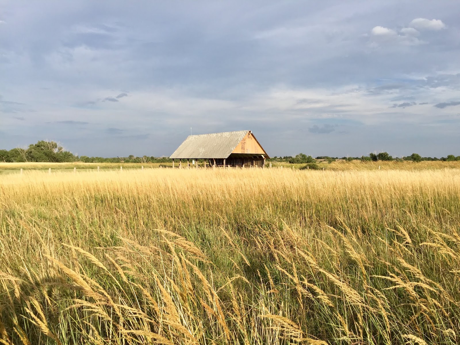
Land and sky indeed! This region is described as “high plains” and
with nothing – scarcely any trees, no buildings, no grain silos, no farm
equipment, no barns – obstructing the panoramic scene around me, all I saw,
really, was green-gold grassland and a cloudless blue sky. This awesome byway ended at Sharon Springs
and, by turning east on Rt. 40, I then began the first half of my drive on the
“Western Vistas Historic Byway,” from Sharon Springs to Oakley, with a
round-trip stop, via Rt. 25, to Russell Springs.
As written
in my Kansas Byways publication --
* “Here, in western Kansas, is the Wild, Wild West of legend, where American
Indians hunted bison, pioneers trekked and rustlers roamed – all attempting to
eke out a living.”
* “The region
surrounding the Byway is a geologist’s and paleontologist’s paradise,
punctuated with unusual rock formations and among the best fossil hunting areas
in the world.”
Today’s drive didn’t reveal
rock formations but my side trip to “frontier-era”
Russell Springs was rather interesting.
This small farm community, back in the day of those aforementioned
pioneers and rustlers, was a stagecoach stop on the Butterfield Trail. The Butterfield Trail Museum, located in the
Logan County Courthouse (built in 1887), has information and period artifacts
related to Butterfield’s Overland Despatch Stagecoach Line, “…the primary passenger transportation to
Denver from 1865-1869.” The museum,
much to my disappointment, was closed, “for the season,” the handwritten sign
said. Other than a man with long white
hair and beard on a motorcycle, waving at me, I saw nobody else on this
pleasant Sunday morning. I walked around
and took pictures –
 |
The Logan County Courthouse, built in 1887, is
now the Butterfield Trail Museum.
|
 |
The courthouse, anchored by the jail on the
left and my truck camper on the right.
|
 |
The jail…and some old farm equipment.
|


The
two pictures above are of the St. Francis Episcopal Church, situated directly
across from the courthouse in Russell Springs.
It was a Sunday morning when I was walking around the area but, like I
wrote above, I didn’t see anybody around anywhere…not even one car parked at or
near this church. Walking toward the
church I then noticed the sign that said Sunday services at 4:00 p.m. Since most Christian services that I know of
are conducted in the morning I’m guessing here that the afternoon service is to
accommodate the farmers and ranchers who need to tend to their livestock in the
morning. I walked up to the door,
wondering if it might be unlocked. It
was! I opened the door – quietly, I
hoped – and peered in. Finding the
church empty, I walked inside, making a little noise this time to call
attention to my presence. When nobody
appeared I walked further inside, to the altar, the podium, and to the small
room off to the side where I assume the minister meets with visitors and/or
prepares him/herself for services. I sat
down on a front row pew for a brief moment, hoping somebody would appear so I
could say hello and maybe learn a thing or two about this community. That didn’t happen so I left and walked back
to my truck camper.
Returning to Rt. 40E I soon
reached Oakley, KS and, turning north on Rt. 83, arrived at High Plains Camping
and RV. It was, by then around 12:30
p.m., and the office was closed. The
note on the door said that they…the husband-wife owners…don’t sit around inside
the combo office/store all the time (they live upstairs, I learned later) so
arrivals (like me) are instructed to call the number posted. That I did and about 20 minutes later I was
registered and assigned a site.
Cap’n Jack’s Pub
is situated right on the grounds of this RV park, so I walked over there for
dinner. At first glance this is your
typical pub - football on one large TV and baseball on the other…a full bar
with counter and stools…high tables and booths…a pool table. The menu had something like 10 pages, each
entrée accompanied by a picture of that dish.
I was surprised to see included in the menu, mainly because this
bar/eatery is smack-dab in the middle of a prairie, the assortment of seafood,
fish and shellfish both. I love Fish ‘n
Chips but I ordered the ribeye – my first steak on this trip. It was very good but at 14 oz., plus
vegetables, I couldn’t finish it!
Leftovers for dinner tomorrow!
 |
A prairie sunset, the campground at Oakley, KS.
|
MONDAY, SEPTEMBER 23
Not
having far to go today I didn’t leave the RV park until around 10:15 a.m.,
getting back on Rt. 83S to drive along the second half of the “Western Vistas
Historic Byway.” About 20 miles later, I
turned east onto a narrow dirt road and followed the signs to Monument Rocks
National Landmark – “Formed from deposits
left by the Western Interior Seaway, these Cretaceous chalk formations are
stunning to capture from sunrise to sunset.” Just before I got there, seeing a RV van
approaching from the direction of the rocks, I moved over a bit and stopped to
let the van pass. That driver stopped
too and we both lowered our windows. He
gave me a grin and a thumbs-up, prompting me to ask if the rocks were right
over there. His reply -- “You can’t miss them!”
Won’t wonders ever cease! Speaking of wonders, these rock formations,
some of which are more than 50 feet tall, are designated “Kansas’ first national Natural Landmark and one of the 8 Wonders of
Kansas.” Truly awesome. They look just like the rock formations so
prevalent in the Southwest. BUT here, these
ancient rocks are strikingly beautiful when seen at this one exclusive spot
surrounded by the grassy and agricultural landscape of the Kansas prairie. Across the road is another section of rock
formations called Little Pyramids. I
walked around, sidestepped cattle dung (the rocks are on private property), felt
the texture of the rocks, and took a bunch of pictures. Still on the dirt road – 17 miles total with
several left and right turns – I reached Rt. 83, stopped at the nearby Keystone
Gallery for a look around (primarily fossils) and then continued south to Rt.
95S.
 |
On the road to Monument Rocks.
|
 |
Some cows along that gravel road.
|
 |
Monument Rocks…
|
 |
A keyhole peek out into the prairie.
|
 |
From the other side, the group of rocks called
Little Pyramids. That’s cattle dung in
the foreground.
|
 |
One of the rock pillars collapsed some years
ago…note the jagged edge and the cluster of rock pieces. Visitors are asked not
to climb these rocks.
|
 |
But we can touch them…
|
 |
| This visit called for a selfie with my “Bestie!” |
 |
The “BOD” stands for “Butterfield Overland
Despatch” - associated with the Butterfield Trail Museum that I wanted to visit
in Russell Springs yesterday. “The Butterfield
Overland Despatch trail used Monument Rocks as a landmark to guide travelers through
the region.”
|
 |
The marker and the rocks…
|
 |
…and modern day farm equipment nearby.
|
 |
Passing through chalk bluffs on the way back to
the highway.
|
My destination was the Historic Lake Scott
State Park where I had reserved a site for today and tomorrow. On the way there I saw, just up ahead, what
looked like a traffic situation. A big
truck was stopped on its lane (going north, I was going south) and I could see
a couple of other vehicles that were weaving in and out of both lanes. Approaching slowly, I saw the reason – a
horse had gotten loose and the driver of the pickup truck was trying to block
its path with his truck. The horse,
trotting along, and that pickup were both on the shoulder of my lane. The big truck up ahead had obviously stopped
to prevent vehicles from coming down on that lane. I moved over to the left lane to give the
pickup driver space to maneuver this chase.
The second vehicle, a car, was following closely behind, also on the
shoulder of my lane. Soon as my route
was clear, I drove on…but sure do wonder and hope, of course, that the chase
ended safely for everyone.
Around 1:30 p.m. I
arrived at my reserved site at the Historic Lake Scott State Park. My “reserved” tag wasn’t attached to the post
and I was about to go look for the Campground Host when she herself came
walking towards me, waving the orange tag all the while. Apologizing for not having inserted the tag
before now, Pam explained that she had had a “pet emergency” this morning. I responded that it was no problem and then I
asked “How’s your pet?” Pausing for just a moment, Pam said she had
to put him down…her cat. I said I was so
very sorry…I understand…I love cats, dogs, too.
We talked for a few more minutes then she went back to her motorhome and
I set up my camper.
Unfortunately, the site I
selected – relying best I could on the online diagram of the state park’s
campground map, which didn’t include site pictures – is so-so. While I can see some of Lake Scott through
the dining windows my primary view is the restroom structure and six dumpsters. Ah, well, you win some and lose some.
 |
Craggy hills surrounding Lake Scott, Historic
Lake Scott State Park, near Scott City, KS.
|
TUESDAY,
SEPTEMBER 24
I spent a couple of hours
this morning driving around this beautiful state park, described as “Hidden within a western Kansas prairie, the
park is a startling oasis of natural springs, deep wooded canyons, and craggy
bluffs; A 100-acre lake, created by a dam constructed in 1930, is nestled among
the picturesque hills.” My first
stop was the El Cuartelejo Indian Pueblo, the “Only Known Indian Pueblo in Kansas.” The photos below describe this
pueblo…


Having previously read about a herd of bison
in this area I stopped by the state park office and asked the lady there about
their whereabouts. She took me outside
the office and pointed out the fence line that wound around a bluff and ended
at the rear of the office. Within that
enclosure is grass and a water tank and the bison, she said, can be seen there
-- when they decide they want to graze on that particular spread of grass
and/or they want a drink of water from the tank. She said there’s about 25 bison, they
sometimes go down in the canyon, but she saw them in that enclosure when she arrived
for work at 8:00 a.m. this morning.
Hopefully I’ll see them on my way out of the state park tomorrow
morning.
Oh, a bit of “Little Miss Muffet”
excitement this morning. Before I got in
the truck a nickel-size spider, attached to an invisible strand of its web,
came swinging down from the visor and landed on the top of my steering
wheel. Quickly recovering from the image
of that spider hanging inches from my face while I’m driving, I calmly reached for
the state park brochure and whacked the spider, causing it to fall to the
floor, after which I flicked it out the door.
At least, I hope I did…I looked to see where it ended up but didn’t find
it…
WEDNESDAY,
SEPTEMBER 25
The morning started off with
a nice sunrise. But then, about ten
minutes before I left my campsite, the entire sky became a solid blanket of
gray. I got going, stopping first at the
state park office where I, with my binoculars, scanned that fenced
enclosure. Seeing no bison I headed out,
turned right onto Rt. 95S, and that’s when I saw them. Being on the highway at that point I couldn’t
park anywhere, so I drove slowly (no vehicle was behind me) and looked at them.
There were maybe 10 bison and the hide
on some of them, like the lady yesterday had mentioned, was white. They’re not albino, she said, the white
coloring is due to a genetic trait.
Beautiful animal. Sad history…
Being a loop road, Rt. 95 soon re-connected with Rt.
83 and I continued south on this, the “Western Vistas Historic Byway” to its
end at Scott City. There I turned left
and drove about 100 miles east on Rt. 96, then taking Rts. 183N and 4E to
Hoisington, KS, my stop for tonight. The
Hoisington RV Park is actually a parking lot behind the Hoisington Recreation Center. There are 12 spots with electricity and
water, for $15.00 per night. So far -
it’s 4:30 p.m. as I write this - I’m the only RVer here. From where I’m sitting at the table, the rec
center is behind me and a wide-open grassy field is in front of me. To my right is Rt. 4 and there’s a Dairy
Queen across the road. I’m here because
Hoisington is the northern starting point for my drive tomorrow on the
“Wetlands and Wildlife National Scenic Byway.”
It didn’t rain today…it’s now mostly cloudy…and it’s a little bit windy…
 |
The “parking lot” RV Park at Hoisington, KS.
|
 |
The clouds were mesmerizing at sunset. This is the open grassy field behind my
camper at 6:35 p.m., looking east.
|
 |
Looking west, 6:41 p.m.
|
 |
7:12 p.m.
|
THURSDAY,
SEPTEMBER 26
From the Kansas Byways publication: “The
Wetlands and Wildlife National Scenic Byway is a birder’s paradise. See all kinds of waterfowl, shorebirds, and
even whooping cranes on this 77-mile stretch from Hoisington to Stafford on
Kansas Highways 4 and 156. This route
includes two important wetlands – Cheyenne Bottoms and Quivira National
Wildlife Refuge – and boasts 60,000 acres of wetlands.”
And this quote:
“Navigate Cheyenne Bottoms on a
self-guided driving tour and abandon all your old ideas about Kansas being flat
and dry.”
As crucial stopovers along this
flyway for migratory birds, spring and fall are said to be the best times to
see as many water bird species as possible.
For those sightings you really have to traverse deep into the refuge
areas, not just drive around it…which I what I ended up deciding to do
today. Because. Weather. The clouds last night, which so mesmerized
me, today appeared to threaten rain.
From my
“parking lot” site in Hoisington I had to drive on Rt. 4E for about 12 miles to
connect to the byway. Before reaching that
starting point I saw the sign for “Cheyenne Bottoms” and promptly turned onto
that road – a dirt road. That’s when my slight
twinge of apprehension occurred – dirt turns muddy, ya know, when it rains.
“Lemme just see what’s ahead…” I thought to
myself, “…after all, that’s why I call
these journeys ‘MAP’s Camper Adventures’” - with the emphasis on adventures. Venturing slowly down the dirt road my first “adventure”
was encountering a swarm of Red-winged Blackbirds. There must have been 100 of them, both on the
road and along the grassy/weedy sides. As
I slowly approached closer those birds, like the click of a switch, took to the
air at the same time and parted, like the Red Sea, into two swarms. It’s amazing how they do that…no strategizing
necessary.
Spotting a backhoe up ahead (I learned
later they do work on the canals throughout the refuge) I turned back to the
highway, splitting up those Blackbirds again, and got on the byway. A few miles later I stopped at the Kansas
Wetland Education Center to get information.
The fellow assisting me, in reply to my inquiry, said that most of the fall
migratory birds had started arriving in July, they’ve flown off and there may
not be much variety in water bird species at this time. He gave me a printed self-guided driving tour
map and, yes, all those refuge roads are gravel/dirt. Before leaving I looked around – impressive
exhibit tracing the history of the land and wildlife around here, the damages
the White Man caused, and today’s conservancy programs. The exhibit included a pair of Black-Tail
Prairie Dogs, my first opportunity to see them up close.
The first gravel road on my printed guide led to an observation
tower and I decided to go there. There was
a deep dip in that road and a sign read “Impassable
in high water.” Right, there’s water
everywhere here and rain can cause flooding.
I got up to the tower with my binoculars and scanned the wetlands around
me. The grey sky, unfortunately, took
away much of the color I would have liked to see from that height. But for one or two white egrets I didn’t see
other water birds. Deciding not to drive
further on that gravel road I resumed my drive on the byway, which ended at Rt.
281. I soon connected to Rt. 50E for the
drive to South Hutchinson. It finally
did rain on that drive…just a little bit.
 |
Red-winged Blackbirds, taking off en masse at
my approach.
|
 |
Black-Tail Prairie Dogs at the Kansas Wetland
Education Center.
|
 |
The cloudy day wasn’t helpful but this is a
view from an observation tower of one of the “pools” within the Cheyenne
Bottoms Wildlife Area.
|
Arriving
at the Lighthouse Landing RV Park and Cabins in South Hutchinson I got a site
for tonight and tomorrow. The office is
actually an old one-room schoolhouse and when I made a comment about that, the
lady registering me started fingerspelling “Clark
County, Nebraska.” Oh, the
schoolhouse was transported here from Nebraska?
Yes, she said…the owner of this RV Park wanted it and arranged for that
transport. Just as I was about to ask the
question they get all the time here, she gave me their brochure and pointed to
the section: “Why a Lighthouse in the
middle of Kansas you’re asking????”
This is the printed answer --
“A Lighthouse is a symbol of guidance, direction and a destination. As pioneers moved west into the treeless
prairie, they experienced a similar sensation a person has when on water with
no land in sight, the tall wind driven prairie grass resembled ocean
waves. Their covered wagons also
resembled small ships and therefore were called prairie schooners. So, with that history in mind & a
lighthouse still being a symbol of direction & guidance, why not a
lighthouse in the middle of Kansas.”
Wow, for
a water-loving Navy Brat (that would be me!) that statement is
thought-provoking! Inasmuch as I admire
the pioneers for the hardship and the struggles they endured, I will always
feel conflicted about the actions of the White Man – his “forked tongue” and
the mindless near destruction of this country’s Native Americans and native
animals, specifically the bison. Progress
was inevitable, I know that, but the gesture of respect would have been decent,
moral, and honorable. That holds true
today…from all of us.
The only lighthouse I saw
here is a framed photo of the Cape Hatteras Lighthouse. But, being that this is a new RV Park in
South Central Kansas, a “work in progress,”
maybe the owner will install an exterior lighthouse of some sort later. Speaking of
water, however, I didn’t notice until after I set up the camper but there’s a
pond directly behind my site. And
paddling right by were 20 Canadian Geese.
Checking out the restroom when I later went out to walk around, I
counted six frogs in one of the stalls.
Goodness, I’ve got my very own “wildlife refuge” right here!
 |
Canadian Geese behind my camper - “my very own
wildlife refuge,” Lighthouse Landing RV Park and Cabins, South Hutchinson, KS.
|
FRIDAY,
SEPTEMBER 27
I watched the sun rise this
morning. The dark clouds are gone, the
sky is blue. I scanned the pond, nice
and blue and rippling a bit in the breeze.
Seeing no geese, I concluded they’ve continued on this – their migratory
flyway – to the south. Swallows, a
fascinating species of bird, were flitting around above the pond early this
morning, catching their breakfast of insects in the air.
I got to work on Blog #10 – this one – pausing often to gaze at the
pond…and the sky. A white egret stopped
by, wading along the edge and stabbing at the water. Around noon, having decided to stay here
tomorrow as well, I went to the office to pay.
It’s almost 3:00 p.m. as I write this.
The egret is still around and I’ve seen a couple of vultures hovering in
the sky – alive or dead there’s edible stuff hidden in the tall grass. Those
birds won’t win a beauty contest but they sure do have a graceful way of
soaring in the sky…their method of hunting.
Oh,
just now a group of birds – mostly white with some gray and a touch of black -
have been skimming the pond, apparently to take a drink. Their size and coloring made me think seagull
but, unlike seagulls, which will land in water and float around, these birds have
been skimming the surface of the water and then immediately taking to the
air. Through my binocs I tried but was
unable to determine whether these birds have webbed feet or not. As skimmers, I’m guessing they don’t.
Did I mention I’m in the midst of my very own wildlife
refuge?
Late afternoon clouds came rolling
in. Mesmerized again, I took pictures –
 |
Clouds above the RV Park. The small building is the one-room schoolhouse.
|
 |
The schoolhouse…the clouds…as the sun is
setting…
|
 |
Sun-kissed…
|
 |
Sunset over the pond…
|
 |
That’s me, raising a toast to the sunset, to the
clouds, to the wildlife, to the birds, and to Kansas.
|


