MONDAY, SEPTEMBER 16
It’s late
afternoon as I write this and I’m looking out my dining window towards a woodsy
area. The leaves of the nearby trees and
the tallgrass surrounding those trees are having a dance with the wind. It’s quite pretty when the sun, which is
having a dance of its own with the clouds, glistens on those green and golden
colors – Mother Nature’s masterpiece.
Visible to my right, through the kitchen window is a blue body of water
– the Cedar Bluff Reservoir. I
self-picked-self-paid for my site here at the Cedar Bluff State Park, just
south of Ogallah, KS.
Having arrived at the
Triple J Campground in Russell, KS last Friday (13th) I had myself a
quiet, but busy weekend. It took me the
better part of Saturday (14th) to update and edit my 8th
blog of this trip. After posting that
blog I determined that I needed another “driving break” day…so I stayed at
Triple J on Sunday (15th) as well.
I’m glad I stayed longer for several reasons…
* I
bumped into this woman, my age maybe, who was walking her dog. At first glance – thick white fur, curled
bushy tail – I guessed Samoyed. Right,
it was, but what I didn’t notice right away were its eyes – this 10-year old
Samoyed was blind. The lady explained
that the dog developed glaucoma and needed surgery when the pressure became
painful. Facing me and letting me
massage its ears I was looking at slits instead of eyes. Smell and hearing heightened in compensation,
the dog is happy and doing very well, the lady said.
* I
also ran into cats! Not only did
the campground owner have a small dog in her office, she also had five – maybe
more – cats that hung around outside the office and elsewhere. I didn’t try to pet any of them. Inasmuch as I adore cats, I know better…them
claws and teeth…really would be wise to check with the owner first. From my bed, that Sunday night, I
smelled…skunk! Stuff happens when you
have free-roaming cats…assuming this was a cat-skunk encounter.
* On Saturday it was hot and very windy; less hot and
less windy on Sunday. I was glad not to
be driving on both days…gotta keep a tighter grip on the steering wheel when
driving a truck with a camper on top.
* Since I
had cable hookup I watched some football on TV.
The Washington Redskins – because I lived for many years in the D.C.
area – is my favorite team. I watched
them lose to the Cowboys (again). Maybe,
if they respectfully change their name, they’ll become a formidable team once
again.
So, this morning, around 9:15 a.m., I
hopped in the truck and, by way of I-70W, soon connected to Rt. 283S (at WaKeeney)
where I began my drive on the “Smoky Valley Scenic Byway.” The 60-mile rectangular byway, from the
southward direction I took, turned east on Rt. 4 and then north on Rt. 471. The 560-mile Smoky Hill River cuts through
this byway and the Smoky Valley name “…evokes
images of a hazy-blue-gray mist rising out of the river valley, punctuated by
limestone bluffs and unique rock formations, reminders of the marine character
of this place millions of years ago.”
Miles
of farmland on the byway and then, in the middle of this wide open space – a
church, the Zion Lutheran Church, built by Volga-German immigrants in
1905. It really doesn’t take much to
imagine the early 20th Century landscape around this prairie. The church’s steeple and front door may be
only a few yards from the pavement of Rt. 283, but that pavement may have been
- 114 years ago - if not yielding a crop of some kind, a simple dirt road. I parked and, noticing a play area behind the
church, walked over there first. The one
swing, the teeter-totter, and the merry-go-round were quite old, the metal
rusted, the wood splintered. Their story
I don’t know but I took pictures…and of the church as well.
Turning north on the byway’s Rt. 471 I started to see
the aforementioned limestone bluffs which quickly transformed the flat farmland
I’d just been driving on to hillier terrain.
Spotting the sign I’d been watching for, I turned left onto a gravel
road that led me to the Cedar Bluff State Park.
Described as “straddling” the Cedar Bluff Reservoir, the state park has
a north shore and a south shore. I
didn’t know this state park has two entrances but I’m at the south shore, called
the Page Creek Area.
From my self-pick/pay site I
can see just a bit of the water but, being that I’m too far to determine if
this lake has also flooded, I decided to take a walk for a look-see. I almost put on my ecco sandals, which I’d been wearing for weeks now, but changed my
mind and put on socks and sneakers instead.
So very glad I did!
The sandy soil near
the water’s edge was a landmine of weeds and it wasn’t long before I felt
something sharp at my ankle. Looking
down I was surprised to see about 20 or so prickly sharp pea-sized burrs, clinging
to my socks and sneakers! Reaching down
to pick a burr off with my fingers, I stopped short of doing that, remembering
something I learned in Tucson, AZ about the jumping cholla cactus. Those things will stick to your fingers and
if you try to use the fingers of your other hand to pick ‘em off, they’ll then
stick to those fingers. I found a stick
and when that one stick wasn’t working out I got a second stick and, using the
ends of both sticks like a tweezer, picked the burrs off one by one. Now, if I had worn my sandals…
Anyway, rather than flooding, I think the water at
this section of the reservoir may have shrunk somewhat. I didn’t see any boating or fishing anywhere,
nor did I see ducks or other water birds.
There are, however, a lot of grasshoppers here, completely invisible in
the grass until they start jumping every which way.
 |
Zion Lutheran Church, “Smoky Valley Scenic
Byway.”
|
 |
The playground behind the Zion Lutheran Church.
|
 |
Gravel road towards the south shore of the
Cedar Bluff State Park.
|
 |
A grasshopper, quite pretty against the blue of
my camp chair.
|
 |
A section of the reservoir at Cedar Bluff State
Park.
|
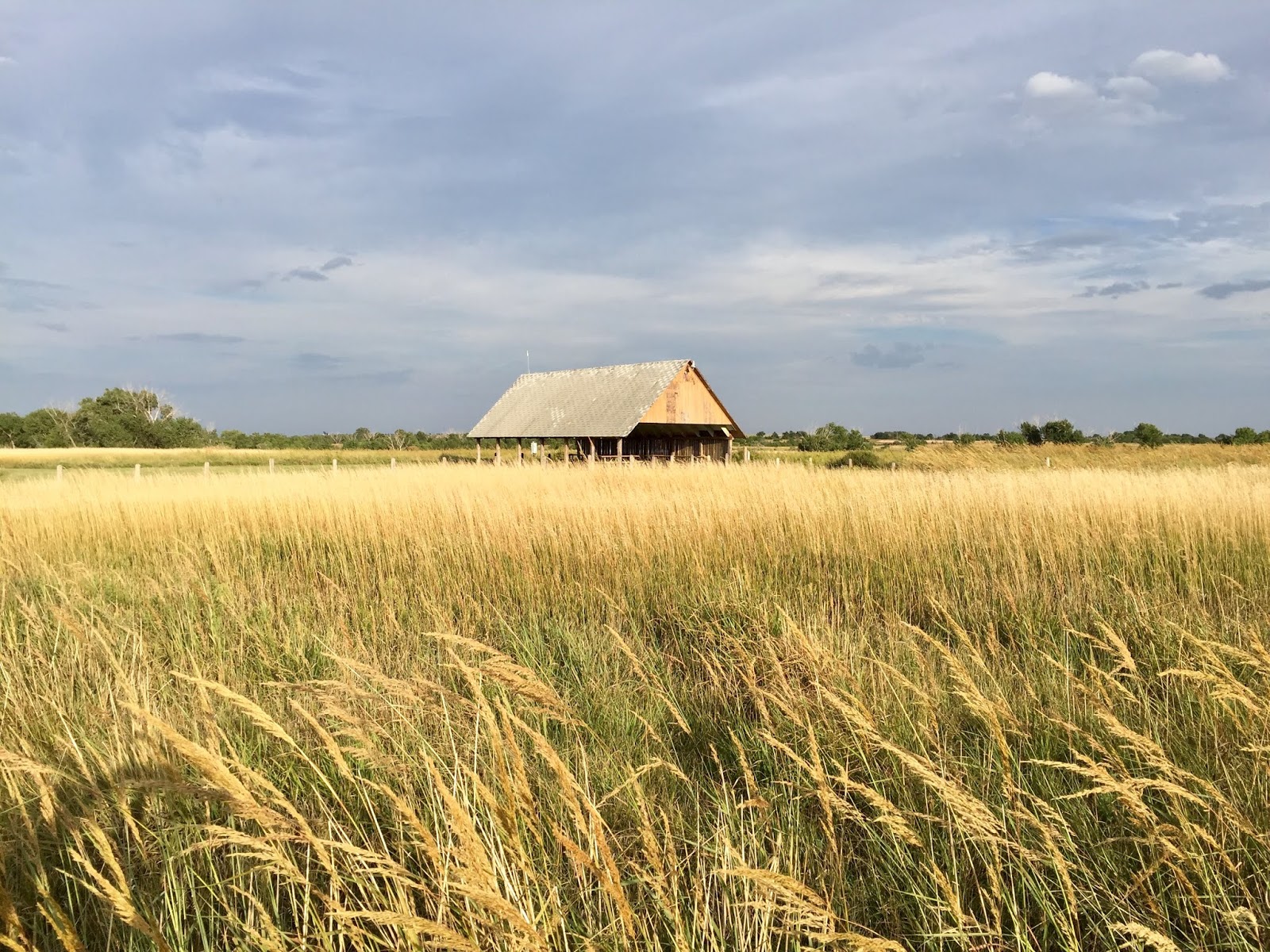 |
Sure looks like wheat but since I don’t know I’ll
describe this as a “golden field of tallgrass.”
|
 |
| A nice palette of colors, I think! |
 |
How about them sunset colors!
|
TUESDAY,
SEPTEMBER 17
Noting where the sun set
last night I knew exactly where it would rise this morning. But, back to last night for a moment, around 9:45
p.m. I stepped outside and looked up at the stars. There were no lights at this campground, and
only a few clouds, both of which helped to see a darkened sky. There was no moon either, which puzzled me
because we had a full moon just last Saturday.
Not long after going to bed, around 10:15 or so, I noticed that it
seemed to be a little brighter outside.
Looking out the window behind me, there was the moon, slowly rising from
the east – the exact same spot where I saw the sun rise this morning.
Taking the same gravel road back to Rt. 147 I turned
north to continue my drive on the scenic byway.
The north shore of the Cedar Bluff State Park was just ahead but “Road
Closed” barriers stopped me before I even reached the entrance to that section
of the state park. [NOTE: Checking
online later, “A portion of the Smoky
Valley Scenic Byway in Trego County will be closed until the bridge spanning
the Cedar Bluff Reservoir spillway can be replaced…”]
There was no “detour” sign nor was there anything
posted by way of advisement for an out-of-state traveler like me. To my left was the water, to my right was the
prairie…and a gravel road was beckoning.
It was 9:30 a.m., I’ve got all day, and so I turned onto that road – Y
Road was its name. I had to laugh…yeah,
Y - “why” - am I even on this road?! I
reached an intersection with another gravel road, 370 Road if I recall, stopped
right there and considered my sense of direction. Based on the sun’s location Y Road was going
due east, which meant a left turn on this numbered road would be going north. I-70 is to the north, therefore, do I want to
make this left turn? I decided to see if
my location appeared on my iPhone’s GPS…it did…and as I was considering my
options two trucks came from the south and turned right onto Y Road.
Y Road, which by now was a dirt road (fortunately,
dry!), won the toss and I went straight ahead, keeping my eye on the GPS along
the way. They say that the GPS is not
always reliable and that was indeed the case with me when I was instructed to
make a left turn and the GPS started doing that “rerouting” thing. I’m going north now, however, that much I
could determine. About a minute later I
came upon a small oil pipeline facility of some sort and, spotting the white pickup
truck parked near the open gate, I stopped.
When I got out of my truck so did the fellow that had been sitting in
his truck. I explained what happened
with Rt. 471 and, yes, I’m looking to get on I-70. Struggling at first, holding his pen and a
piece of paper, to explain how to get there from here, he then looked at me,
pocketed his pen, and said for me to follow him. It was no problem, he assured me, when I said
I didn’t want to keep him from his work, so I followed him – or rather, his
trail of dust because he drove rather fast.
At the spot where he stopped and pointed out the road to I-70, I got out
of my truck to give him a thank-you hug.
He gave me the pen and well wishes for a safe journey!
Happy to be heading now towards I-70, I felt some
disappointment at not being able to complete my drive on the rest of the scenic
byway. I wanted to see the dam at that
reservoir, the water itself, and I also wanted to stop and visit another church
– the Swedish Evangelical Lutheran Emanuel Church, “…built by Swedish settlers in 1902 out of limestone.” As it turned out, however, I really didn’t
miss a thing. I can see another dam,
another bridge, another reservoir, another church, somewhere else. The significance of getting lost on those
dirt roads in the middle of a wide-open prairie on a sunny day (windy, too!)
became apparent when I spotted, at a distance this lone structure, surrounded
by nothing but prairie. I found a place
to park and walked towards that building.
I’ll let my pictures below describe this part of the experience.

Driving on the correct dirt road towards I-70,
as I was approaching an intersection with another dirt road, I saw the water
first -- the blue color stood out against the dominate green/gold/brown colors
of the prairie. I slowed to a stop when
I then saw the structure near that water.

As I walked closer to this
building I noticed the limestone posts around it. There was no driveway, no sign of activity…

The limestone posts were evenly
spaced. I would have liked to walk
around that area but thought I best not…

This structure, in the
middle of a Kansas prairie, has a story.
When was it built? Why was one
section constructed with wood and the other section with stone? Was it a home? When was it abandoned? And why?
So, you see, a Midwestern prairie, like here in Kansas, holds a lot of
secrets and even a maze of dirt roads can turn out to be scenic in their own
right.
Back on I-70W,
I returned to WaKenney, registered for a site at the KOA there, and then went
to town to do a few errands. I got a BLT
sandwich for lunch at a nice restaurant, walked that off by going to the nearby
grocery store for a case of water and other items, and then, ready for my
chocolate milkshake, got that at the soda fountain inside the town’s drugstore.
WEDNESDAY,
SEPTEMBER 18
The distance from the WaKeeney
KOA to Norton, KS, via Rt. 283N, is about
60 miles…an hour’s drive. I was on my
way around 9:45 a.m., happy to see that it was a sunny morning….and very much
relieved to note that the strong winds of the past couple of days had subsided
significantly. It was a nice,
comfortable drive – a “Sunday Drive” on Hump Day.
At
Norton I turned left onto Rt. 36W and soon arrived at the Prairie Dog
State Park, located on the north shore of the Keith Sebelius Reservoir. As I’d done at some of the other state parks
I checked out a couple of campgrounds, picked the site I wanted for tonight,
and went back to the office to pay for it.
The site I selected gives me a great view of Sebelius Lake and, being that
my site was the first one on that particular row, there will be no RV next to
me to block my view. Getting here as
early as I did – around 11:15 a.m. – probably helped make it possible for me to
get such a good site.
With the “Reserved” tag securely
attached to my campsite post, I then drove around the state park to see some of
their highlighted features --
* Within the park
is a thriving colony of black-tailed
prairie dogs. I went to the
observation area where both prairie dogs and I observed each other. I had my binoculars with me but couldn’t get
decent pictures with my iPhone.
* Not far from
that colony is a preserved 19th Century one-room schoolhouse –
Hillman School (1887). I walked around
there but couldn’t go inside.
* From the
schoolhouse I drove to the trailhead of the 1.4-mile nature trail and took a
walk along that well-maintained trail.
There were interpretive signs along the way describing the vegetation
and the wildlife, reptiles, and birds that inhabit this area.
* Following that leisurely and much needed walk I
returned to my campsite to set up the camper.
That done, I then walked over to the lake’s designated beach to check it
out. I decided not to take a dip there,
which was just as well because I ended up with a few burrs on my shoes and
socks.
* Finally, I walked over to the second
vintage 19th Century building at the state park – a renovated adobe
house, built in the 1890s, the “…last
remaining adobe house in Kansas.” An
engraved plaque outside the house reads: “Our
Lady of the Prairie – Kansas Adobe
Home on its original foundation.”
Peering through the windows I could see furniture and other items
inside. Like the schoolhouse, this
building was also locked.
 |
| The one-room schoolhouse in the background, Prairie Dog State Park. |

 |
| A section of Sebelious Lake, as seen from the state park’s nature trail. |
 |
Renovated adobe house, exactly where it was
built in the 1890s.
|
 |
Me, and one of the few limestone posts left at
the adobe house.
|
THURSDAY, SEPTEMBER 19
Before leaving the Prairie Dog State Park, I took a picture --
 |
Something I don’t see often…the sun rising
above a lake - Sebelious Lake.
|
Today I drove a little over 100 miles on Rt. 36W from
the Prairie Dog State Park to St. Francis, KS, located at the northwest corner
of Kansas – about 20 miles south of the KS-NE state line and about 11 miles
east of the KS-CO state line. The town
intersects with Rt. 27, about 90 miles of which is the “Land and Sky Scenic
Byway.” From the north, the byway starts
at the KS-NE state line but since I planned to turn south on Rt. 27 at St.
Francis I didn’t drive that stretch of the byway.
Earlier,
before I knew exactly where the “Arikaree Breaks” was located, I had
contemplated staying overnight at a 5-site roadside park in St. Francis so I
could visit that region. The Arikaree
Breaks landscape is described as unique – a Kansas version of the “Badlands” –
and there is a lot of Indian history in that area. A self-guided map is recommended but I couldn’t
seem to locate an Info Kiosk or Visitors Center in town. I did spot a small sign with an arrow
pointing out the direction to Arikaree Breaks so I went that way just to see what
was ahead. I ended up on a dirt road and
after driving about a mile on that road I decided I’d had my fill of dirt roads,
for right now, and turned back towards town.
Arikaree Breaks, I learned later, is right at the KS-NE state line, 20
miles further north.
So, I got on Rt. 27S and got
a site for today and tomorrow at the KOA in Goodland, KS. Over the next few days, until I veer
eastward, I’ll be on Mountain Time.
Settling in and happy to have gained an hour, I did my usual stuff –
stats, journal, blog. Then, as dusk approached,
the sky darkened and the camper started rocking! The wind, my gosh! There had been no wind all day and now it was
coming on strong, so strong I decided to retract the slide-out in order to
minimize the shaking there. I’ve got an
excellent cable connection here at my site so I called it a day, shut down the
laptop, hopped up on the bed, and watched TV.
 |
Darkening sky, looking east from my KOA campsite,
Goodland, KS.
|
 |
Same location, looking west.
|
Today’s
drive, three hours or so on Rt. 36, going west, was a really nice drive through
changing terrain and changing weather.
It was alternately sunny and cloudy, with some light rain – but no wind! When the clouds moved off, giving me a crisp
blue sky, I could clearly see, directly in front of me, the moon, not quite yet
a half-moon, but hanging there in the sky.
And then a bonus – no mistaking the V formation of a skein of geese
flying by. The green-gold terrain,
fields of crops here and fields of grass there, morphed from flat to hilly,
then hilly with rocks, then flat again. Heading
south on Rt. 27, finally, something different - fields of a dark brown color. Farmers were working on those fields, tilling
the soil is my guess.
FRIDAY, SEPTEMBER 20
I
actually slept well last night – the wind had subsided enough the camper didn’t
rock at all through the night. The wind has
picked up again, just a little bit, on this nice, sunny day. I’m taking a driving break today…gonna finish
this blog, review my travel materials, watch some TV, and hopefully get started
on my fourth book of the trip - Stephen King’s End of Watch.
I will continue on the “Land
and Sky Scenic Byway” when I resume my journey tomorrow…or maybe on Sunday...
Your appreciation for nature ... animals, insects, earth, wind and fire ... comes across so clearly in your writing. I love how you find something interesting in all you see, old buildings and old people ☺️.
ReplyDeleteAnother excellent description of what you are experiencing along your journey through Kansas. You can check out my Fb posts to see what Bon and I have been doing in and around Wever lately! Wonderful photographs of the scenery included in your blog. Safe travels! D and B
ReplyDeleteYou certainly have seen the Prairie!!! Just think about the long ago travelers coming across in wagons! And pretty rough ground!
ReplyDeleteSo glad you have had this experience... The USA is quite vast when you think about it. Lots of land....
Will enjoy hearing more comments when I see you.
Cheers! Betty L.
Wonderful recap and great pics of areas I’ll likely never see :)
ReplyDelete